The Parish of Woburn in General
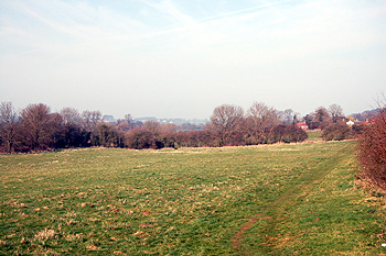
View from Timber Lane towards Aspley Guise March 2012
Landscape
The underlying, or solid geology of Woburn is a sandstone known as Woburn Sands Formation. It was laid down 99 to 121 million years ago in the warm, shallow seas of the Cretaceous Period. This results in a largely sandy subsoil though in the area of Crawley Road the soil is of a type known as till, a diamicton formed during the Ice Ages. There are also area, around Park Farm and Birchmoor Green, where the subsoil is a mixture of clay, sand, silt and gravel known as Head, washed down from slopes by the action of water.
The new Saint Mary’s church stand at 388 feet above sea-level. Woburn Abbey is ten feet lower than this but areas of the wildlife park, specifically the highest part of the lion enclosure, rises to 445 feet. Utcoate Grange is 383 feet above sea-level whilst the main road from Woburn to the A5 above the farm rises to a maximum of 436 feet. The Birch at Birchmoor Green stands at 349 feet and Speedwell Cottages average just over 420 feet above sea-level.
Volume III of The Victoria County History for Bedfordshire was published in 1912. At this date the parish of Woburn comprised 3,446 acres, of which around 2,000 were permanent grass and 700 arable, most of the rest being wooded. The main crops were wheat, barley, oats, peas and beans.
![From George Street to Speedwell in 1810 [R1/240]](/CommunityHistories/Woburn/WoburnImages/From George Street to Speedwell in 1810 [R1-240]_352x62.jpg)
From George Street to Speedwell in 1810 [R1/240]
Name
Woburn is first recorded in a charter of King Edgar granting land in Aspley Guise, it is referred to as Woburninga gemære. In the Domesday Book of 1086 it is called Woberne. The name means "winding stream" from the Old English words woh (twisted) and burna. The name has undergone a number of variations over the years as the following shows:
- 969-1229: Woburninga gemære;
- 1086: Woberne;
- 1086: Woburne;
- 1130-1164: Wobburn;
- 1170: Weburna;
- 1202-1268: Wuburn;
- 1202-1389: Wouburn;
- 1227: Wburne;
- 1236: Wubburn;
- 1307: Woughburne;
- 1332-1377: Wobourne;
- 1332-1381: Woubourn;
- 1526: Wooburn;
- c. 1750: Woobourne;
- c. 1750: Woburn
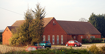
The Village Hall March 2012
Administrative History
Woburn is an ancient parish in the Manshead Hundred. It is surrounded by: Aspley Guise to the north-west; Husborne Crawley to the north; Ridgmont to the north-east; Eversholt to the east; Milton Bryan to the south-east; Potsgrove to the south and the Buckinghamshire parish of Little Brickhill to the west.
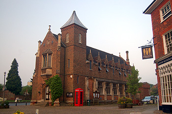
The Town Hall May 2012
Local Importance and Relative Decline
The population of Woburn in 1086 was nineteen, though these would have been just the heads of household. To arrive at an approximate figure one needs to multiply this number by at least four to account for dependents – a population of around a hundred, not particularly large for the era. No doubt the arrival of the Cistercian abbey in 1145 increased numbers in the town
Woburn was long a market town, the original charter, for a weekly market on a Friday, being granted to the Abbey by King Henry III in 1245. He also granted the right to hold a three day fair in September each year (a spiritual ancestor of the recently created Oyster Festival). The local importance of the market can be seen at a glance by the number of inns, public houses and beerhouses the town once contained. Ironically, King Henry VIII awarded two additional fairs to the Abbey, one in March, the other in July, just nine years before he dissolved the institution.
A market hall was erected in 1737 by the fourth Duke of Bedford the today the Town Hall, rebuilt in 1834, occupies the site (now filled with antique shops). The town has had a number of fires, the first on 13 September 1595 resulting from a cottage fire, the second in November 1645, during the Civil War as the result of a raid by Royalist troops which destroyed 27 houses in the north end and the third in June 1724 which destroyed 39 houses.
Woburn has declined somewhat in importance in the 20th century. It used to have its own Petty Sessional (Magistrates Court) Division and its own Workhouse, receiving paupers from neighbouring parishes and Poor Law Union to run it. The Petty Sessional District was created in 1830 and dissolved in 1953. The Poor Law Union, created in 1835, was dissolved in 1899. Woburn's main importance now is as a place for tourists visiting Woburn Abbey and the Safari Park.
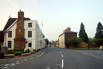
View south along George Street May 2012
Population
- 1801: 1,563;
- 1811: 1,506;
- 1821: 1,656;
- 1831: 1,827;
- 1841: 1,914;
- 1851: 2,049;
- 1861: 1,764;
- 1871: 1,605;
- 1881: 1,316;
- 1891: 1,193;
- 1901: 1,129;
- 1911: 1,122;
- 1921: 1,060;
- 1931: 951;
- 1951: 864;
- 1961: 846;
- 1971: 796;
- 1981: 815;
- 1991: 776;
- 2001: 939;
- 2011: 933.
The decline mentioned in the paragraph above is particularly striking in these figures. In 1801 Woburn was the 6th largest parish in the county (behind Bedford, Saint Paul, Biggleswade, Eaton Socon, Leighton Buzzard, Luton and considerably more than places like Ampthill, Dunstable and Sandy), today [2012] it stands in 63rd.