Potton Pound
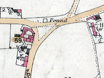
The pound marked on a map of 1884
A pound was a form of manorial justice and exaction. It was an inclosed space where straying animals and goods taken from people who had forfeited on fines were placed. The animals or goods could only be redeemed by their owner paying a fine to the Lord of the Manor.
The Bedfordshire Historic Environment Record [HER] contains information on the county’s historic buildings and landscapes and summaries of each entry can now be found online as part of the Heritage Gateway website. The entry for the pound on Everton Road [HER 10667] states that it is not shown on a manorial map of 1754 [W2/9]. Indeded, at that date the pound was in Gamlingay Road. The entry for that pound [HER 10660] notes that it was quare and stood on a triangular space on the junction of Hatley Road with Gamlingay Road. The inclosure map of 1832 shows neither Gamlingay Road, nor Everton Road pound.
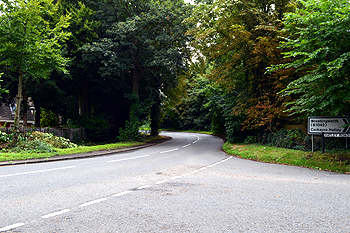
The site of the pound in Gamlingay Road August 2013
In 1936 Bedfordshire Historical Record Society published Volume III of its Survey of Ancient Buildings series. This contained a survey of pounds in the county written by J. Steele Elliott. He wrote the following: “The brick-built Pound was demolished about 1915. It stood at Pound End on the north side of the Everton-Gamlingay road nearly opposite to the Biggleswade turning and close to the Rising Sun Inn”. It is marked on the 1st edition Ordnance Survey 25 inches to the mile map for Potton as seen above.
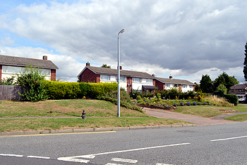
The site of the pound on Everton Road August 2013