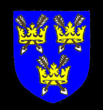
The arms of Saint Edmunds Abbey
Kinwick was a hamlet of Sandy. It is first mentioned in the Domesday Book of 1086 was Chenemonewiche, showing that the original meaning of the name was "Cynemund farm", It seems to have been last mentioned in the Inclosure Award for Sandy of 1804 as Kinwick Field. The name had a number of different forms at different times:
- Kenemundby: 1212;
- Kenemundewich: 1220-1242;
- Kenemundewyk: 1220-1242;
- Kenendewyk: 1242;
- Kynemundewyk: 1252-1287;
- Kinemundewik: 1252-1287;
- Kynemundeswik: 1276;
- Kylmundewyk: 1332;
- Kynwyke: 1535.
The entry in Domesday Book stated that Kinwick was held by Saint Edmund's Bury Abbey in Suffolk. The manor comprised three hides, three virgates and had six villagers. These would have been the heads of household and the total needs to be multiplied by a factor of at least four to allow for wives and children suggesting a population on twenty five or so. There was a mill, which shows that Kinwick lay on a river as only watermills were known in England in 1086. It was worth 13 shillings and 4 pence.
In 1066 two freemen of King Edward the Confessor had held the land and after 1066 Earl Waltheof gave it to Saint Edmund's in alms. In 1066 the manor had been worth £4 which had shrunk drastically to 30 shillings when the abbey acquired it. By 1086 the value had risen to 60 shillings. It is suggested by historians that the reason for the general lowering of the value of manors in the area is accounted for by William I's armies coming through Bedfordshire on their way to put down rebellions in the north. They would have lived off the land and no doubt have committed certain acts of vandalism in what was, to them, still alien, even enemy, territory.

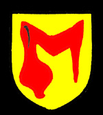
The Hastings family arms
The first County Archivist, George Herbert Fowler discussed Kinwick in the fifth Bedfordshire Historical Records Society volume, published in 1920 (pages 61-73). He argued that there were two holdings in Kinwick. One is that mentioned in Domesday Book which, by 1242 was held by Henry de Hastings. Another holding in Kinwick was, by 1242, part of the Barony of Eaton and John de Andeville granted a virgate of it to the monks of Saint Neots around that time and Fowler argued that the holding had become distinct from the Domesday holding before 1135.
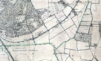
Fowler considered that Kinwick lay in the south-eastern corner of Sandy, in the area of Sandy Heath and Warren Farm and in part of Sutton, considering that Kinwick's mill, recorded in Domesday, actually lay in Sutton, which had no mill in Domesday but clearly later had one as recorded in the names of Millhouse Fen and Watermill Bridge which are recorded on Ordnance Survey maps of the late 19th century, as well as on modern maps. Millhouse Fen lies north of Portobello Farm and Watermill Bridge on Biggleswade Road south-east of the farm.

The area of Kinwick seen on a late 19th century Ordnance Survey 6 inches to the mile map - to see a larger version, please click on the image
Further evidence for Fowler's theory comes from the Sandy Inclosure Award of 1804 where an allotment to Francis Pym is described as: "Also one other piece or parcel of land or ground containing thirty seven acres, one rood and thirty nine perches situate in Kinwick field bounded on the south by the Cambridge way" [A14]. Finally, Volume 41 produced by Bedfordshire Historical Records Society in 1961 is devoted to 13th and 14th century coroner's rolls for Bedfordshire from the National Archives, edited and translated by R. F. Hunnisett. It records the murder of Gilbert the Shepherd of Kinwick in 1270 who "went from his house in the hamlet of Kinwick in the parish of Sandy to his sheepfold a furlong outside the town on the east". His body was later found on Sandy Heath.