Sandy Maps
The following maps are only a selection of those held at Bedfordshire and Luton Archives and Records Service.
The image below is taken from the inclosure map for Sandy of 1799 [MA14]. The buildings have been highlighted in red. To see a larger version, please click on the image.
![Sandy in 1799 - buildings highlighted in red [MA14]](/CommunityHistories/Sandy/SandyImages/Sandy in 1799 - buildings highlighted in red [MA14_202x300.jpg)
Sandy in 1799 - buildings highlighted in red [MA14]
The image below is taken from the 1st edition Ordnance Survey 25 inches to the mile sheet for the area north of Sandy of 1884. To see a larger version, please click on the image
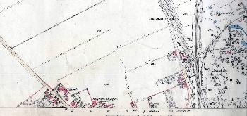
The area north of the Market Square in 1884
The images below are taken from the 2nd edition Ordnance Survey 25 inches to the mile sheets for the area around Sandy of 1901. To see a larger version, please click on the relevant image
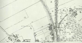
The area north of the Market Square in 1901
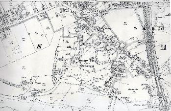
The Market Square and the area to the south in 1901
The image below is taken from the 3rd edition Ordnance Survey 25 inches to the mile sheet for the area around Sandy of 1926. To see a larger version, please click on the image
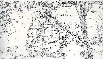
The Market Square and the area to the south in 1926