The Parish of Toddington in General

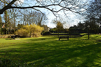
Toddington Pond and Memorial Gardens March 2016
Landscape
Volume III of The Victoria County History for Bedfordshire was published in 1912. At that date the parish of Toddington contained 5,535½ acres, of which 1,195¼ were arable land producing wheat, barley, oats, beans and peas, 2,524½ were permanent grass, and 113 acres were woods and plantations.
The ground undulates and averages from 350 feet to 450 feet above sea level, rising to 500 feet in the west of the parish at Herne Grange and Herne Farm. The church stands at a height of 492 feet above sea level. The land falls sharply away from the village to the north and east. The River Flitt runs through the parish, entering in the south and flowing due north past Mill Farm where a water mill was in operation until the early twentieth century.
The solid geology is a sedimentary rock known as Gault Formation, a mudstone laid down between 99 and 112 million years ago in the shallow seas of the Cretaceous Period. The superficial geology is largely glaciofluvial deposits of sand and gravel laid down during the ice ages of the last 2 million years. There are areas of till, a diamicton also deposited in the ice ages, around Toddington Park, Herne Willow Farm, Herne Farm and Happyland Farm.

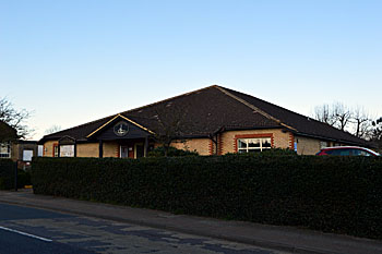
Toddington Village Hall March 2016
Administrative History
Toddington is an ancient parish forming part of Manshead Hundred. It is a large, irregular shaped parish and contained two hamlets, Fancott and Chalton. In the 21st century Chalton became a separate civil parish. Toddington is surrounded by the parishes of Tingrith, Westoning and Harlington to the north and north-east, Sundon to the east, Luton to the south and south-east, Houghton Regis to the south-west, and Chalgrave, Battlesden and Milton Bryan to the west. In the eighteenth century Toddington was a thriving market town, but its importance began to wane by 1800. The modern village centres on a central green known as Church Square where five roads, leading to Luton, Houghton Regis, Leighton Buzzard, Woburn, and Ampthill meet. Confusion over whether Toddington is a town or a village is perfectly expressed by a reference in the bye-laws to the " on the Village Green".

Name
The name Toddington means the Hill of Tuda's People and is first seen as "Tudincgatun" in an Anglo-Saxon charter of 926. A. Mawer and F. M. Stenton in their 1926 publication The Place-Names of Bedfordshire and Huntingdonshire tell us that the early forms of the name with "o" rather than "u" were spelling variants, but they eventually came to affect the pronunciation.
The name has had the following variations over the years:
- Tudincgatun: 926
- Dodintone: 1086
- Totingedone: 1086
- Tudingedon: 1166-1243
- Tudingeden: 1180
- Tudingeton: 1186-1299
- Todingedon: 1187-1287
- Tudinton: 1194-1244
- Tuddingeton: 1198-1227
- Tudingetun: 1198
- Tundingedun: c/1200
- Totingedun: c.1200
- Tudington: Tudyngton: 1219-1392
- Tudingdon: Tudyngdon, 1227-1287
- Todingdon: Todyngdon, 1227-1292
- Todington: Todynton, 1227-1526
- Tuddingetun: 1232
- Tudendon: 1232
- Tudingesdon: 1239
- Tutdingedon: 1242
- Tuddingdon: 1244
- Totingdon: 1276
- Totynton: 1342
- Totyngdon: 1382
- Tudyngdown: 1388
- Tuddington: 1576-1780
- Taddington: 1662
![The High Street about 1900 [Z1306/126]](/CommunityHistories/Toddington/ToddingtonImages/The High Street about 1900 [Z1306-126]_350x213.jpg)
The High Street about 1900 [Z1306/126]
Population
The Domesday Book of 1086 states that Toddington comprised 42 villagers, 19 smallholders and 19 slaves. This total of 80 people represents only the heads of households and so needs to be multiplied by a factor of at least four to suggest a total population of nearly 250, making it a good-sized town for the period (Luton and Leighton Buzzard had around 500 people, and Houghton Regis about 220).
The occasionalvisitation by the Bishop of Lincoln to Bedfordshire in the early 18th century gives important social information. Each vicar or rector had to complete a return about his parish. These are particularly useful for the state of education but give other insights. Former County Archivist Patricia Bell has compiled returns from 1706 to 1720 for the Bedfordshire Historical Records Society (Volume 81, published 2002); the returns for Toddington state that in 1709 there were 160 families in the parish with a population of over 500 (only twice that in 1086); there were 191 families in 1712, and 154 in 1717 and 1720.
Census returns enable us to chart the changes in the population of Toddington from 1801:
- 1801: 1,143
- 1811: 1,182
- 1821: 1,665
- 1831: 1,926
- 1841: 2,225
- 1851: 2,438
- 1861: 2,433
- 1871: 2,464
- 1881: 2,159
- 1891: 2,087
- 1901: 1,962
- 1911: 1,948
- 1921: 2,001
- 1931: 2,500
- 1951: 2,275
- 1961: 3,327
- 1971: 4,045
- 1981: 4,237
- 1991: 4,424
- 2001: 4,467
- 2011: 4,585
The figures include Fancott throughout and Chalton up to and including 1991. The decline in population after 1871 is accounted for by the great agricultural depression from about 1873 to about 1896 when people were forced off the land and into nearby towns in order to find work. The village grew substantially over the second half of the twentieth century, with considerable building to the south stretching almost to the boundary with Chalgrave.