The Parish of Southill in General

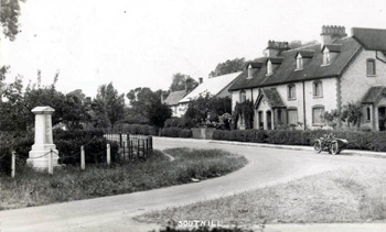
Southill - the Stanford Road junction - about 1920 [Z1036/106]
Landscape
Volume III of The Victoria County History for Bedfordshire was published in 1912; at that date the parish comprised 6,094 acres and 3 roods of which 3,122 acres were arable, 888 acres, 3 roods permanent grass and 341 acres were woodland. The church stands at 160 feet above sea-level, the mansion in Southill Park is higher at 195 feet, the school lower at 145 feet above sea-level.
Most of the village has an underlying, or solid, geology of greensand. This sandstone is called Woburn Sands Formation and was laid down between 99 and 121 million years ago in the warm shallow seas of the Cretaceous Period. Laid down considerably earlier in the Jurassic Period, between 154 and 164 million years ago, was a mudstone called Oxford Clay Formation. This underlies the area to the north of the village.
Wrapped around the village in a kind of reverse C is an area of superficial geology called till. This is a diamicton laid down by glaciers during the mid-Pleistocene Epoch ice ages. More of this till lies above the Oxford Clay Formation as does a glaciofluvial deposit of sand and gravel.

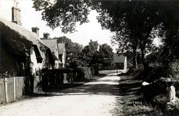
Southill - School Lane - about 1900 [Z1036/106]
Name
Southill is an ancient parish containing just over 6,000 acres (2,400 hectares) lying in the Wixamtree Hundred. It was first recorded in the Domesday Book of 1086 as Sudgiuele and Sudgible. The parish has had a wide variety of spellings down the years including: Sudgill (1197); Sutivele (1214); Sugivele, Suziueve and Sugyvel (1215-1219); Sutgylle (1242); Suthigiuel and Suthgyvel (1200-1329); Suthyeuele (1227-1327); Suggivel (1229-1247); Suggeuel (1247); Sutyvell (1273-1287); Sugul and Sugil (1276); Southyevel (1338-1451); Southyevill (1400); Southiell and Southyell (1515-1548) and Southwell (1518-1582). What this variety of spellings makes clear is that the origin of the name is not south hill but south Ivel. Today the river only forms a small portion of the eastern boundary and is nowhere wholly in the parish.

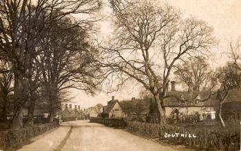
Southill about 1920 [Z1130/106/5b]
Administrative History
Southill is an ancient parish. Southill village sits more or less in the centre of the parish which is bordered by Biggleswade and Langford to the east, Clifton to south-east, Shefford and Campton & Chicksands to the south, Haynes to the west and Old Warden to west and north. The parish includes the hamlets of Broom (in the east), Stanford (in the south east), Ireland (in the south-west) and Rowney (in the west).
In 1903 the ecclesiastical parish of Southill lost some of its area which was transferred to the new ecclesiastical parish of Shefford. The civil parish of Southill lost some of its land to Shefford in 1933, including Shefford Mills.

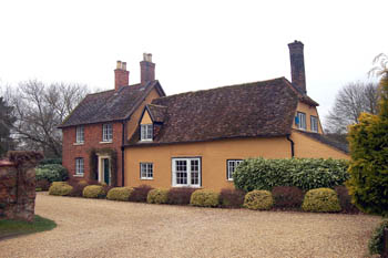
Church Cottage March 2008
Population
The Domesday Book of 1086 notes 29 people as part of the various manors in Southill itself and a further 36 from Stanford and Broom; if this is multiplied by, say, four to reflect these men's dependents this gives a total of around 120 for Southill and over 250 for the entire parish, proportionately far greater than today.
The Hearth Tax of 1671 (transcribed in Bedfordshire Historical Records Society Volume 16 in 1934) records 136 dwellings in the parish of Southill, including Broom and Stanford, for a total of 280 hearths. It has been estimated that this represented a population of about 578. The largest number - thirteen - were in the house of Lord Chief Justice Keeling. The house of Benjamin Randall contained a forge, clearly suggesting he was a smith.
Volume 81 published by the Bedfordshire Historical Records Society (2002) is devoted to returns made during episcopal visitations to the county by the Bishop of Lincoln in the early 18th century, edited by former County Archivist Patricia Bell. One of the questions asked was the number of nonconformist families in the parish; the various responses were as follows:
- 1706: 130 families;
- 1709: "Families 120. Souls about 569";
- 1712: 150 families;
- 1717: 150 families;
- 1720: 150 families
In the last two hundred years the population of Southill has changed comparatively little and has, in fact, declined from a high in 1851; as the following figures show:
- 1801: 985;
- 1811: 1,024;
- 1821: 1,165;
- 1831: 1,267;
- 1841: 1,379;
- 1851: 1,400;
- 1861: 1,391;
- 1871: 1,351;
- 1881: 1,227;
- 1891: 1,143;
- 1901: 1,054;
- 1911: 989;
- 1921: 1,031;
- 1931: 1,105;
- 1951: 1,078;
- 1961: 991;
- 1971: 1,127;
- 1981: 1,102;
- 1991: 1,022;
- 2001: 1,143;
- 2011: 1,192.