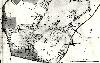
Southill Maps
The following maps are only a selection of those held at Bedfordshire and Luton Archives and Records Service. To see a larger image of each map, please click on the appropriate thumbnail.
From the Whitbread Archive
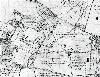
Southill Inclosure Map of 1800 [W2/26]
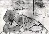
northern part of Southill Park 1817 [W3375/2]
southern part of Southill Park 1817 [W3375/2]

Southill in 1818 [W3375/1]
Ordnance Survey 25 Inches to the Mile 2nd Edition Maps - 1901

Southill east 1901

Southill central 1901

Southill west 1901