The Parish of Old Warden in General
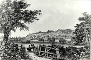
Old Warden about 1872 [Z50/129/6]
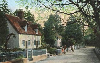
Landscape
Volume III of The Victoria County History for Bedfordshire was published in 1912. At that time the parish of Old Warden comprised some 3,364 acres of which 2,055 were used for arable farming, chiefly wheat, barley, beans and peas and 889 acres were permanent grass. 611 acres were woodland and formal gardens.
Old Warden lies in a dip slope of the Greensand Ridge in the Ivel Flood Plain. Most of the parish has a solid, or underlying, geology of a greensand sandstone known as Woburn Sands Formation, laid down between 99 and 121 million years ago in the shallow seas of the Cretaceous Period. In the area of Shuttleworth Park and to the north the solid geology is a mudstone called Oxford Clay Formation laid down between 154 and 164 million years ago in the shallow Jurassic seas. Mostly the soil reflects the soild geology, sand or clay. There is an area of glacially deposited till running in a rough C shape west of the village.
Old Warden church stands at 212 feet above sea-level and Oak Farmhouse near the boundary with Cople and Northill about 216 feet. The lowest point is where Hill Lane meets the A1 and lies at about 88 feet above sea-level. Other spot heights include: Lakeside Cottage at 140 feet, Warden Abbey ruins at 195 feet, the airstrip at 115 feet and the Hare and Hounds at 195 feet.
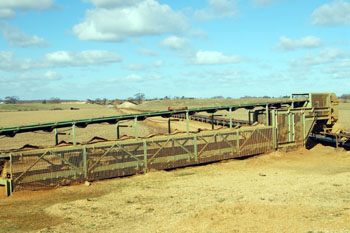
Gravel workings March 2008
There are large gravel workings in the east of the parish. They cover a large area between the roads to Southill and to Broom just south of Hill Lane.
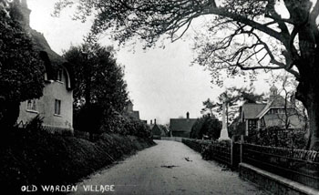
15 High Street and the Village Hall about 1920 [Z50/129/130]
Administrative History
Old Warden is an ancient parish. It lies in the hundred of Wixamtree and is bordered by Cople (north), Northill (north), including, most directly, Upper Caldecote, Biggleswade (east), Southill (south) including, most directly, Broom, Haynes (south-west), Eastcotts (west) and Cardington (north-west).
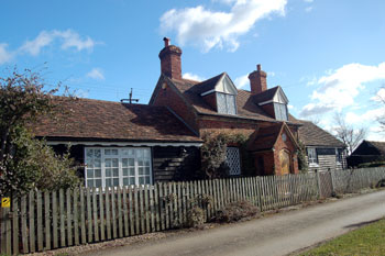
141 Warden Street March 2008
Name
Old Warden occurs in the Domesday Book of 1086 as Wardone; it has had a variety of spellings down the years, including: Wardun (1158-c.1230); Warden (1215-1444); Waredon (1227-1262); Wardoun (1383-1393); Old Wardon (1495); and Worden (1785-1798). The name probably comes from the Old English weard-dun or "watch hill". The hamlet of Warden Street was first recorded in 1537, being termed Wardon in le Strete in 1549.
47 to 50 High Street about 1920 [X758/1/12/79]
Population
Old Warden has never been a populous parish, but today's population is only about 40% of that at its highest known point in 1821. The reasons for this include smaller families and less jobs on the land and the Shuttleworth estate meaning families moved away over the years. Interestingly, the Domesday Book of 1086 lists at least 26 residents in one manor, 27 if the Lord is included. This figure must be multiplied by a factor of at least four to include these men's dependents, giving a total of just over a hundred, a reasonable size for a Bedfordshire village of this date.
The Hearth Tax of 1671 (transcribed in Bedfordshire Historical Records Society Volume 16 in 1934) records 45 dwellings in Old Warden for a total of 156 hearths. It has been estimated that this represented a population of about 187. The largest number - thirty six - was in the house of Sir William Palmer. One house was empty.
Volume 81 published by the Bedfordshire Historical Records Society (2002) is devoted to returns made during episcopal visitations to the county by the Bishop of Lincoln in the early 18th century, edited by former County Archivist Patricia Bell. One of the questions asked was the number of nonconformist families in the parish; the various responses were as follows:
- 1706: about 60 families;
- 1709: "Families above 40; about 140 souls";
- 1712: "Families near 50";
- 1717: about 50 families;
- 1720: "Three score and eight families" i.e. 68
The figures for the last two hundred years are as follows:
- 1801: 455;
- 1811: 492;
- 1821: 670;
- 1831: 660;
- 1841: 630;
- 1851: 627;
- 1861: 597;
- 1871: 534;
- 1881: 498;
- 1891: 413;
- 1911: 406;
- 1921: 388;
- 1931: 349;
- 1951: 343;
- 1961: 457;
- 1971: 402;
- 1981: 269;
- 1991: 248;
- 2001: 277;
- 2011: 328.