The Parish of Thurleigh in General

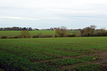
Looking north from the High Street, January 2015
Landscape
The solid, or underlying, geology of Thurleigh is known as Oxford Clay, a mudstone which was laid down in warm, shallow Jurassic seas between 154 and 164 million years ago. The superficial geology is a type of diamicton called Oadby Member.
Thurleigh lies on a plateau which, although not particularly elevated in terms of sea level is sufficiently raised to feel quite exposed. The church and the former windmill, for example, both stand at 250 feet above sea-level.

Name
The name Thurleigh means "at the clearing", the final element being the Anglo-Saxon word "leah" meaning a clearing in wooded land. The name has changed significantly over time and the following forms are found:
- La Lega (1086-1202);
- La Leye (1220);
- La Legh (1227);
- De la Releye (12870:
- De la Reyleye (1287);
- Relye (1309-1427);
- Thyrleye (1372);
- Relegh (1387);
- Reliegh (1393)
- Rely (c. 1400);
- Thurle (1461);
- Thyrlee (1483);
- Thurley alias Relegh (1518);
- Thurly (1526);
- Thurlye (1526);
- Thurlighe (1528);
- Thyrlye (1535);
- Thirlegh (1535);
- Thirlye (1549).
Thurleigh is first recorded as the name in 1641.

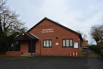
Thurleigh Village Hall, January 2015
Administrative History
Thurleigh is an ancient parish in the Willey Hundred.

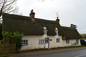
6 High Street - Novel Hovel, January 2015
Population
The Domesday Book of 1086 recorded 9 villagers, 24 smallholders and 6 slaves in Thurleigh. These would have been heads of household, suggesting a population of around 150 or more, making it a large settlement for the time. Censuses from 1801 record the following figures for the parish:
- 1801: 411
- 1811: 457
- 1821: 477
- 1831: 538
- 1841: 617
- 1851: 698
- 1861: 666
- 1871: 619
- 1881: 603
- 1891: 529
- 1901: 485
- 1911: 433
- 1921: 416
- 1931: 404
- 1951: 460
- 1961: 531
- 1971: 636
- 1981: 612
- 1991: 603
- 2001: 692
- 2011: 694