The Parish of Harrold in General
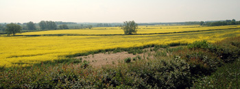
Rape fields near Harrold, May 2008
Landscape
Volume II of The Victoria County History for Bedfordshire was published in 1908 and at that time the parish comprised 3,241 acres of which 1,382.5 were used for arable farming and 1,396.75 acres were permanent grassland. The main crop was wheat.
The solid, or underlying, geology beneath the village is a limestone interbedded with clay minerals known as the Great Oolite Group. This was laid down between 164 and 169 million years ago in the warm, shallow seas of the Jurassic Period. North of the village the solid geology is a mudstone known as Rutland Formation, laid down between 164 and 176 million years ago.
The superficial geology along the river is alluvium - a mixture of sand, gravel, clay and silt. Most of the village has a soil known as river terrace deposit - a mixture of sand and gravel. This gives way to clay soil north of the village.
The church stands at 156 feet above sea-level and the bridge 143 feet. Dungee Farm Cottages in the north of the parish stand at 280 feet and Park Wood ascends to 370 feet above sea-level.
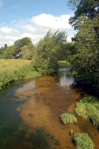
River Great Ouse looking upstream towards the church, June 2008
Name
The name probably means: "boundary on rising ground" - the first element the Old English "har" can mean grey or a boundary, the latter seeming more likely as Harrold is on the boundary of three counties, Bedfordshire, Buckinghamshire and Northamptonshire. The second element is "weald" or "wold" meaning rising ground.
The name has had many variations throughout history including the following: Hareuuelle in the Domesday Book of 1086; Harewold (1163-1476); Harewolda (1163-1476); Harewuda (1167-1220); Harawald (1194); Harewde (1227); Harewode (1227-1331); Harwode (1232-1234); Harwald (1236-1287); Harewald (1236-1287); Harwold (1240-1528); Harwolde (1240-1528); Harewaud (1240-1253); Horewald (1247); Horwold (1276); Harwood (1525); Yarrold (1560); Harwood (1610-1730); Harwood (c.1750). The modern form of the name is first recorded in 1346 in the Calendar of Inquisitions post mortem.
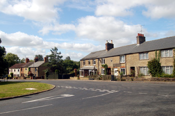
Folly, June 2008
Administrative History
Harrold's neighbouring parishes are: Bozeat in Northamptonshire to the north-west; Lavendon in Buckinghamshire to the south-west; Carlton and Chellington to the south-east and Odell to the north and east. Harrold is an ancient parish with few hamlets save for Folly, to the north on the west side of Odell Road which is now connected to the village and Santon. The latter has been identified as a deserted medieval village and kiln complex through earthworks. It lies in the area of Santon Bar and The Slipe near the Bozeat boundary.
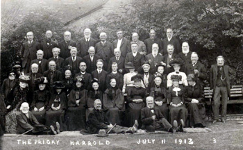
Old people at tea at Priory Gardens in 1913 [Z1306/54]
Population
In the Domesday Book of 1086 the population of Harrold is recorded as ten villagers. This figure needs to be multiplied by a factor of at least four to take into account these men's dependents; even so the population does not look to have been much more than fifty, small even for the time.
The Hearth Tax of 1671 (transcribed in Bedfordshire Historical Records Society Volume 16 in 1934) records 82 dwellings in Harrold for a total of 161 hearths. It has been estimated that this represented a population of about 344. The largest number - fifteen - were in the house of Thomas Brand. Interestingly, no house was recorded as containing a forge. One house was empty.
The occasional visitation by the Bishop of Lincoln to Bedfordshire in the early 18th century gives important social information. Each vicar or rector had to complete a return about his parish. These are particularly useful for the state of education but give other insights. Former County Archivist Patricia Bell has compiled returns from 1706 to 1720 for the Bedfordshire Historical Records Society (Volume 81, published 2002); information for Harrold includes the following:
- 1706: "There are about 120 families in it";
- 1709: "Families 120. Souls 600";
- 1717: "The parish consists of 122 families";
- 1720: "There are one hundred and ten families"
In the last two hundred years Harrold's population has fluctuated by a few hundred either side of a thousand. The population, though larger in proportion to other Bedfordshire parishes now than in 1086 is still not huge - in the 2001 census Harrold was placed 54th out of 124 civil parishes.
The figures for each census year since 1801 are as follows:
- 1801: 763;
- 1811: 796;
- 1821: 939;
- 1831: 995;
- 1841: 1,007;
- 1851: 1,083;
- 1861: 1,119;
- 1871: 1,042;
- 1881: 1,024;
- 1891: 976;
- 1901: 909;
- 1911: 851;
- 1921: 834;
- 1931: 924;
- 1951: 1,019;
- 1961: 956;
- 1971: 1,040;
- 1981: 1,161;
- 1991: 1,118;
- 2001: 1,232