The Parish of Wilshamstead in General
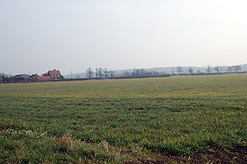
The countryside looking south-east from Elms Lane March 2012
Landscape
Most of the parish and all the area of the village lies above an underlying geology of Oxford Clay. This was laid down between 154 and 164 million years ago in the shallow seas of the Jurassic Period. There are some small pockets of Peterborough Member, a type of mudstone laid down between 159 and 164 million years ago including at Manor Farm and beneath Wilstead Wood. At these locations the superficial geology is a mixture of gravel, sand, silt and clay referred to as head. The remainder of the parish has a clay soil.
Wilstead is mostly low-lying, forming part of the clay vale of the River Great Ouse. The church stands at 141 feet above sea-level and Duck End Farm at 106 feet. Manor Farm lies at 124 feet above sea-leve; and Wilstead Wood, in the south of the parish, climbs southward up Wilstead Hill, varying in height from 166 to 305 feet above sea-level.
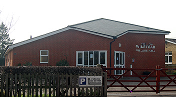
Wilstead Village Hall March 2012
Administrative History
Wilshamstead is an ancient parish in the Redbornestoke Hundred. The village lies towards the south-west of the parish and the hamlet of Littleworth lies in the east of the parish along Cotton End Road. Since 2009 the southern boundary of the parish has also formed the boundary between the two unitary councils of Bedford Borough and Central Bedfordshire. The north-eastern part of the parish is covered by the 21st century community called The Wixams and it seems inevitable that this will one day become a separate civil parish. The parish is currently bounded by: Eastcotts to the east; Haynes to the south; Houghton Conquest to the west and Elstow to the north. A tiny sliver of land borders Stewartby to the north-west.
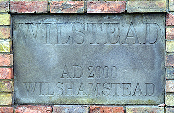
Wilstead sign
Name
Wilshamstead is the full name of this parish though it is often today shortened to Wilstead. The name means Wil’s homestead. The name has undergone a number of variations over the years as the following list shows:
- Winessamestede: 1086;
- Wilsamstud: 1181-13th century;
- Wyleshamstede: 1220-1291;
- Wilchamstede: 1239;
- Wilshamstede: 1240-1276;
- Wilsamstede: 1247;
- Wilhampstede: 1372;
- Wyllsamsted: 1526;
- Wilsumstead: 1675;
- Wilstead: 1729-21st century.
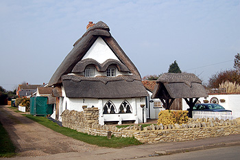
16a Luton Road March 2012
Population
The Domesday Book of 1086 gives forty one people in Wilshamstead and Westcotts combined (probably roughly representing the eastern half of the modern parish). These people were, of course, just the heads of household and so the figure needs to be multiplied by a factor of at least four to give some indication of the real population. This suggests that somewhat over one hundred and sixty people lived in Wilshamstead at the time, making it a large rural settlement for the date.
The figures below show populations for Wilshamstead from 1801 as recorded by censuses. It is interesting to see the population more than double between 1801 and 1851. This caused hardship and poverty as there were simply too many mouths to feed and too many people needing work to be employed on the land. This led to attempts to encourage emigration in the 1840s and 1850s.
Despite this the population still rose, peaking in 1861. After this it began to fall as many people left the land to seek jobs in the growing towns durintg the Great Agricultural Depression which lasted from 1873 to 1896; in Wilshamstead’s case the nearest town was Bedford where the population rose from 11,693 in 1851 to 39,183 in 1911 by which time the population of Wilshamstead had fallen back to the level of 1811.
Wilshamstead’s largest period of growth came between 1961 and 1971 with the addition of much new housing causing an increase of over six hundred in the decade. Since 1981 the population seems to have been stable at just over 2,200.
- 1801: 477;
- 1811: 597;
- 1821: 749;
- 1831: 753;
- 1841: 763;
- 1851: 923;
- 1861: 1,032;
- 1871: 1,000;
- 1881: 820;
- 1891: 787;
- 1901: 689;
- 1911: 587;
- 1921: 589;
- 1931: 675;
- 1951: 880;
- 1961; 1,095;
- 1971: 1,701;
- 1981: 2,255;
- 1991: 2,300;
- 2001: 2,264;
- 2011: 3,270.
The Rating and Valuation Act 1925 specified that every building and piece of land in the country was to be assessed to determine its rateable value. Like most of the county, Wilshamstead was largely assessed in 1927 and the first valuation notebook [DV1/C65] carries a very unkind summary of the parish on the front page: "Cheap Bungalow Colony"!