The Parish of Tempsford in General
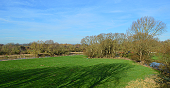
Looking towards the River Great Ouse from the A1 February 2016
Landscape
Tempsford lies nine miles to the north east of Bedford, close to the Cambridgeshire border and on the confluence of the River Great Ouse and the River Ivel. The A1 (Great North Road) passes through the centre of the village, essentially dividing it into two settlements. The properties on the western side of the A1 include the church and the rectory. Those on the east are chiefly centred around Station Road, leading towards the former railway station at Langford End. The division of the village provoked the following reaction from one visitor in 1959: “A wide, noisy main highway, quiet tree-shaded lanes, dreamy river banks: there are no greater contrasts anywhere else in Bedfordshire. Alas! The road widening operations and the increasing barrier of traffic will more surely cut Tempsford in two and perhaps, like Kipling’s east and west, never the twain shall meet. But let us hope that this forecast is unduly pessimistic.” (Bedfordshire Magazine, Volume 7).
Volume Two of The Victoria County History of Bedfordshire was published in 1908. At that date the parish of Tempsford contained 2,340 acres of which 1,060 acres were arable, 1,010 permanent grass and 35 acres woodlands and plantations. The main crops produced in 1908 were wheat, barley, peas and beans.
The bulk of the parish’s solid (underlying) geology is a mudstone called Oxford Clay Formation. It was laid down between 154 and 164 million years ago in the warm, shallow seas of the Jurassic Period. Along the River Ouse the superficial geology is alluvium - a mixture of clay, silt, sand and gravel. Otherwise the superficial geology is a river terrace deposit of sand and gravel.
The parish church of Saint Peter stands at a height of approximately 80 feet above sea level. Nearby Tempsford Hall is a little higher at a height of 95 feet and the River Ouse, to the west of the village, lies at 60 feet.
Name
According to Mawer and Stenton’s Place Names of Bedfordshire and Huntingdonshire (1926), the name Tempsford originates from the nearby River Ouse which, at an early date, was known locally as the ‘Thames’. The Anglo Saxon Chronicle records the death of earl Toglos, a Danish chieftain, at Tempsford in 917 or 921 (interpretations vary), a statement corroborated by the Historia Eliensis which notes that he was killed ‘apud Tamensem fluvium.’
The name has had several variations over time:
- Tæmeseford 921 – c. 950
- Temesanford 1010 – c. 1200
- Tamiseforde 1086 – 1242
- Thameseford 1219
- Tameseford 1220 – 1246
- Temeford 1227 – 1245
- Temiseford 1227
- Temeseford 1227 – 1337
- Temseford 1228 – 1349
- Tamesford 1240 – 1323
- Themes(e)ford 1240 – 1380
- Tamseford 1247
- Temesford 1247 – 1428
- Themisford 1276
- Tamysford 1276
- Tempisford 1526
- Temysford 1551
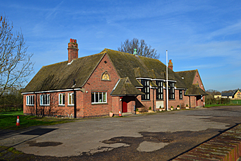
Stuart Memorial Hall February 2017
Administrative History
Tempsford is an ancient parish in the hundred of Biggleswade. It consists of two hamlets, Church End and Langford End. In 1972 it was united with Little Barford to form the ecclesiastical parish of Tempsford with Little Barford. It is surrounded by Wyboston and Little Barford to the north, Tetworth to the east, Sandy to the south and Roxton to the west.
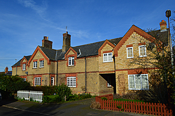
33 to 37 Station Road February 2017
Population
At the time of the Domesday survey in 1086, there were 26 households in Tempsford. To get a true idea of the population this figure should be multiplied by a factor of at least four to allow for women and children, giving a rough figure of 104. This suggests quite a large settlement for the time.
The following population figures are taken from census returns:
- 1801: 409
- 1811: 475
- 1821: 577
- 1831: 535
- 1841: 561
- 1851: 622
- 1861: 566
- 1871: 557
- 1881: 535
- 1891: 492
- 1901: 434
- 1911: 431
- 1921: 468
- 1931: 456
- 1951: 481
- 1961: 491
- 1971: 493
- 1981: 485
- 1991: 474
- 2001: 566
- 2011: 590