Harrold maps
The following maps are only a selection of those held at Bedfordshire and Luton Archives and Records Service. With each map please click on the thumbnail to see a larger image.
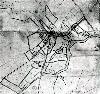
Early Maps

A map of Harrold showing the position before inclosure in 1797 [GA2587]
The Harrold Inclosure Award map of 1799 [MA12]
Ordnance Survey Maps

Folly on the 2nd Edition Ordnance Survey 25 inch to the mile map of 1901

The central part of the village in the 2nd Edition Ordnance Survey 25 inch to the mile map of 1901

The southern part of the village in the 2nd Edition Ordnance Survey 25 inch to the mile map of 1901

The south-western part of the village in the 2nd Edition Ordnance Survey 25 inch to the mile map of 1901

Ordnance Survey 6 inches to the mile second edition map of 1902 annotated by a former County Archivist to show field names