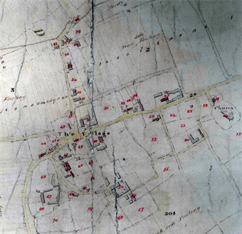
Totternhoe Estate Survey of 1829
Historians of Totternhoe are lucky in that two detailed maps showing the Bridgewater, later Brownlow Estate survive for the early 19th century. The map of 1829 [BW1004] has a reference book detailing all the land holdings on the estate. Of most interest, perhaps, is that fact that each house in the village is marked, together with a description of the area of the property and the name of the person who inhabited it, whether or not the property was owned by the Estate. Extracts from this map giving details of each house and its occupant can be found by clicking on the links below.

Church End in 1829 [BW2004]
The Pest House [Corner of Green Lane, now in Dunstable]
Cottages South-East of the Church [now demolished]
Church End
Houses between Church End and Middle End
Middle End
Lower End
The Northern Part of Knolls View
Cottages at Honeywick
Well Head [now in Eaton Bray]
Doolittle Mill [now in Eaton Bray]