Prehistoric and Roman Carlton
This page was contributed by Pamela Hider

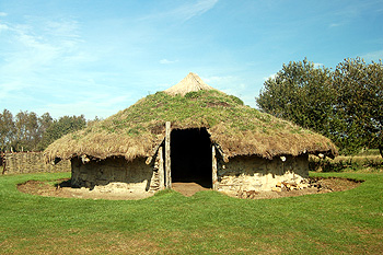
A reconstruction of an Bronze Age round house at Flag Fen October 2011
The Bedfordshire Historic Environment Record [HER] records every prehistoric find and site known in the county. It may now be found on-line at the Heritage Gateway website.
The earliest known trace of human activity in what is now Carlton is thought to date back to the Bronze Age (c.2,700 BC-700 BC). Travel may have been largely by water and so Carlton's situation on the south bank of a major navigable river would have been optimal.
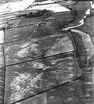
Where settlements of people have dug trenches, engaged in funerary practices, deposited materials or marked out roads, among other things, the condition of the land is affected. This in turn affects how crops grow on that land centuries later. These patterns in the colour and depth of the crops can sometimes only be observed from the air, helping us to identify areas of archaeological importance. These are known as crop marks.
In Carlton, four main areas of human activity can be identified stretching across the Bronze age, Iron age (c.700 BC - AD 43) and the Romano-British settlement (AD 43 - AD 450):
1) Close to the river = west of Carlton Road towards Harrold Bridge; NW of The Moor; west of Marsh Farm; 2) north & south of Pavenham Rd; 3) east & west of School Lane; 4) the area around Great Oaks Wood.
Bronze Age
To the west of Marsh farm near the River Ouse are ring ditches on either side of a pit alignment. Although it cannot be confirmed , it is thought that the pit alignment is related to three ring ditches a little further south of probable Bronze Age date.

Crop marks by the river at Spring Close Farm (courtesy of Carlton and Chellington Historical Society)
Cropmark traces of a curvilinear enclosure of probable Later Prehistoric date, possibly a Bronze Age round barrow, is visible on aerial photographs taken in 2006 by English Heritage. They are located in the large field about 605 metres WNW of Victoria Farm. Cropmarks of two more possible small Prehistoric or Roman round barrow sites (burial mounds) are visible in the same field but nearer the river, WSW of Harrold Bridge.
Iron Age

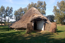
A reconstruction of an Iron Age round house at Flag Fen October 2011
The cropmarks of two phases of probable Iron Age and Roman settlement enclosures are visible on aerial photographs, southwest of The Spinney and East of New Barns Farm. A possible Banjo type enclosure connects to curving boundary ditches and associated smaller curvilinear enclosures and likely represents the earlier phase of the site.
A rectilinear ditched enclosure of probable Iron Age or Roman date is visible as cropmarks on aerial photographs. Located in fields about 225 metres E of the The Causeway.
Roman
Cropmarks north of the Marsh yielded dressed masonry, roof tile, flue tile, mortaria, and pottery fragments of the 3rd to 4th centuries. The finds have been interpreted as suggesting the site of a Roman building, possibly a villa.
Cropmarks of a possible later prehistoric or Roman settlement enclosure visible on aerial photographs are to be found south of Blackwell Spinney close to Great Oaks Wood.
The above are just a few of more than forty pre-historic sites on the Historic Environment Record for Bedfordshire. They are all listed on the Heritage Gateway website in great detail.
Findings of Artefacts
Amongst items recorded by HER are:
- A handaxe thought to be palaeolithic (500,000 BC - 10,000 BC) found NW of the junction of Turvey Rd. and School Lane.
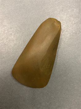
- A polished neolithic (4,000 BC - 2,351 BC) handaxe found just inside the gate of the allotments on The Moor (see image below).
- Iron Age and Roman pottery found west of Hill House (Braehead)
- A Roman brooch from the 2nd century AD found in the field between High Elms and Turvey Rd.
- Roman Coins 'found in Carlton'.
Further details can be found on the Heritage Gateway website.

Neolithic stone axe. Courtesy of The Higgins Museum, Bedford