The Parish of Goldington in General
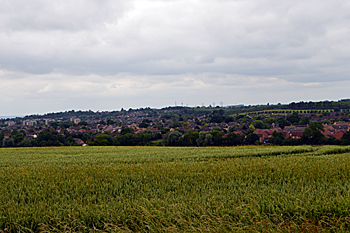
The view over Bedford from Goldington Highfields, now in Ravensden June 2017
Landscape
The solid, or underlying, geology beneath Goldington is a mudstone called Oxford Clay Formation This sedimentary rock was laid down in the warm, shallow seas of the Jurassic Period between 154 and 164 million years ago. As the name suggests it gives rise to clay soils, although along the River Great Ouse is a band of alluvium, a mixture of clay, silt, sand and gravel washed down from upstream. Further back is a band of river terrace deposit of sand and gravel. Much of the rest of the soil is called till - a diamicton formed during the Ice Ages of the last two million years.
All those parts of Goldington close to the river are low-lying: the church stands at 102 feet above sea-level, the former Goldington Bury at 94 feet and the war memorial on Goldington Green at 83 feet. The ground rises to the north, with the area around Woodside Middle School standing at 127 feet. Goldington Highfields, now part of Ravensden, rises as high as 250 feet above sea-level.
Of the original parish volume III of the Victoria County History for Bedfordshire, published in 1912 said: “The parish of Goldington has an area of 2,588 acres, of which nearly half - 1,268 acres - is arable land and 1,161 acres are permanent grass, 37 acres are covered by woods and plantations, and there are 40 acres of land covered with water. The soil is gravelly loam, with a subsoil of clay, and there are one or two old gravel pits in the south of the parish”.
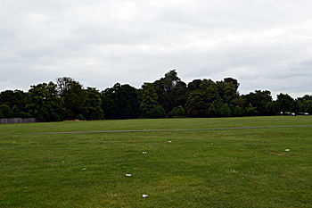
Goldington Green from the west June 2017
Name
The Place Names of Bedfordshire and Huntingdonshire by A Mawer and Frank M Stenton was published in 1926 but is still the most scholarly study of the county’s place names and their origins. The name Goldington means “farm of Golda’s people”. Mawer and Stenton note: “the name Golda only occurs as the name of a moneyer before 1066”. Bedford was a royal mint at times during the Anglo-Saxon period. The name has had a few variations over time:
- Goldentone: 1086;
- Coldentone: 1086;
- Goldinton: 1167-1227;
- Goldington: 1225 to present;
- Goutinton: 1227-1247;
- Goudinton: 1227-1247;
- Goudington: 1227-1247
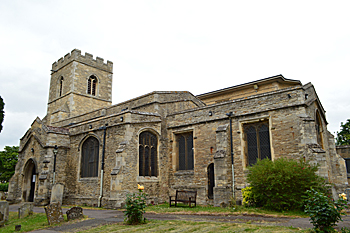
The church from the south-east June 2017
Administrative History
Goldington was an ancient parish in the Barford Hundred. It curved around the Borough of Bedford like a reversed half-moon and included Putnoe and parts of Brickhill and modern Ravensden. The civil parish was abolished in 1934, part being transferred to Ravensden and part to Renhold and the bullk being absorbed into Bedford. With the creation of the new civil parish of Brikhill on 2004, who knows, Goldington may one day find itself a parish once more.
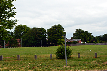
Goldington Green from the south June 2017
Population
The Domesday Book of 1086 records a total population for Goldington, including Putnoe, as 25 villagers, 7 smallholders and 5 slaves for a total of 37. This number represents the heads of household. To get an idea of the total population it is probably necessary to multiply this figure by a factor of at least four suggesting a total population to somewhere around 150 - a large settlement for the time. Censuses were undertaken every ten years in Britain from 1801 and the figures for Goldington, until its abolition as a civil parish in 1934, are as follows:
1801: 339;
1811: 333;
1821: 426;
1831: 494;
1841: 509;
1851: 606;
1861: 609;
1871: 642;
1881: 579;
1891: 587;
1901: 587;
1911: 967;
1921: 1,097;
1931: 1,440.