Goldington Maps
The image below shows the boundaries of the parish of Goldington (in yellow) in 1934, just before absorbtion by the Borough of Bedford and the parish of Ravensden [MCDP54/6/3/2]. Note the long projecting finger westwards along the River Great Ouse. For a larger version please click on the image.
![Goldington boundaries in 1934 shown in yellow [MCDP54-6-3-2]](/CommunityHistories/Goldington/Goldington-Images/Goldington-boundaries-in-1934-shown-in-yellow-MCDP54-6-3-2235x299.jpg)
The image below shows the village of Goldington just before inclosure in 1852 [MA78/1]. To see a larger version please click on the image.
![Goldington about 1852 [MA78-1]](/CommunityHistories/Goldington/Goldington-Images/Goldington-about-1852-MA78-1350x146.jpg)
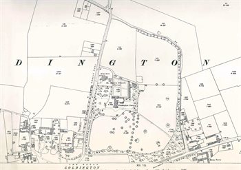
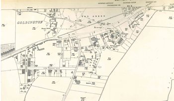
The maps below are Ordnance Survey 25 inches to the mile maps of Goldington and its surroundings in 1926. To see larger versions please click on the appropriate image.
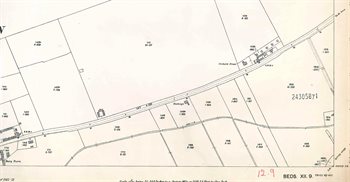
The eastern parts of the village
The area north of Goldington Green
The area south of Goldington Green
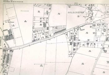
The western part of Goldington
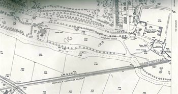
The Longholme area
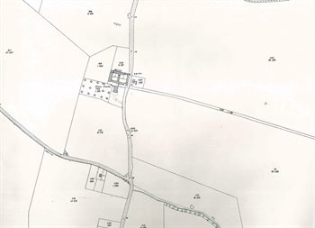
The area around Elms Farm
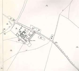
The area around Putnoe Farm