The Grand Union Canal
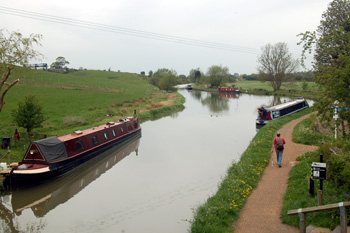
Grand Union Canal looking north from Sandhole Bridge June 2008
Canals as we know them were a creation of the 18th century, although as early as 1515 Canterbury had obtained an Act of Parliament to extend navigation on the River Stour. There is debate about the first modern canal between the Newry Canal in Ulster, which was begun in 1731, the Sankey Brook Navigation connecting Saint Helens [Lancashire] with the River Mersey, opened in 1757 and the Bridgewater Canal connecting Runcorn [Cheshire], Manchester and Leigh [Lancashire] opened in 1761. Until late in the 20th century Bedfordshire had no canals; the small portion of the Grand Union now in the county was wholly within the parish of Linslade and so in Buckinghamshire before Linslade moved into Bedfordshire and became part of the civil parish of Leighton-Linslade in 1965.
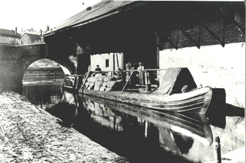
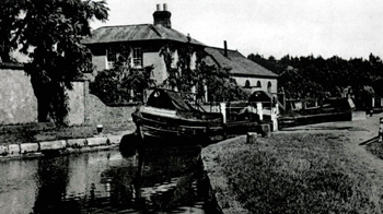
Canal barge at Brantom's Wharf about 1900 [Z50/74/26]
Today's Grand Union Canal was originally called the Grand Junction Canal. The original Grand Union ran only from Foxton in Leicestershire to join the Grand Junction canal near Watford Gap in Northamptonshire. This old Grand Union was purchased by the Grand Junction in 1894.
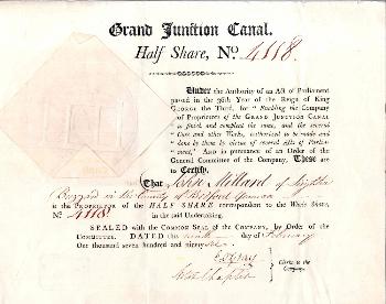
Half share of John Millard in Grand Junction Canal 1796 [NC703]
In 1793 an act of parliament was passed "for Making and Maintaining a Navigable Canal from the Oxford Canal navigation at Braunston in the County of Northampton to join the River Thames at or near Brentford in the County of Middlesex". The idea was to shorten the journey from Birmingham to London which, by canal, involved going via Oxford and Reading [Berkshire]. The stretch of canal through Linslade, linking Fenny Stratford [Buckinghamshire] with London, opened in May 1800.
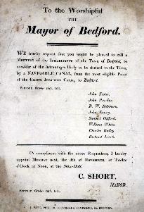
Poster demanding a public meeting to discuss a possible Grand Junction to Bedford Canal in 1811 [X37/29/1] to see a larger image please click on the image above
The canal was so successful so quickly that within a few years nearby towns wanted to connect to it by branch canals. The town of Bedford saw considerable profit from connecting the Grand Junction with the River Great Ouse, which was navigable all the way to The Wash. accordingly in 1811 a proposal was put to the Mayor to convene a public meeting to discuss the matter. The branch canal was never built but every few years the idea resurfaces and in recent years it has been mooted that a canal could join with the Grand Union branch canal in Milton Keynes.
Linslade Lock about 1930 [Z50/72/179]
In the Bedfordshire Magazine Volume 23 number 177 for Spring 1991 Martin Cook and Peter McKeague traced the history of the lock, bridges and wharves of the canal. A single lock, Leighton Lock (despite being in Linslade) formed part of the Linslade stretch. It had a pond or tank on either side which, together, could hold a lock full of water. A plan of 1800 shows the lock and tanks, meaning they were original features. A number of dates on the iron fittings around the lock suggest the dates of some, or all, of the major overhauls: 1863; 1864; 1876 and 1932.
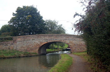
Sandhole Bridge seen from the south October 2008
The canal included six bridges in the Linslade stretch. The one closest to its original design is the one carrying the road from Rushmere in Heath & Reach to the Stoke Road, it is known as Sandhole Bridge and is built of yellow brick, which may have been locally made. A single arch spans both the canal and the tow path, the canal narrowing appreciably under the bridge. The bridge carries a Grand Junction Canal bridge number (110) just above the arch on each side.
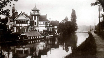
The Martins about 1910 [Z1130/74]
Another bridge spans the canal a little way south, by the Globe public house. Further south again a swing bridge crosses the canal near the lock. Another bridge used to cross the canal south of the lock almost opposite where The Martins, in Bossington Lane (built for an engineer of the canal), used to stand until the 1960s, this bridge was demolished around the beginning of the First World War.
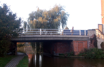
Leighton Road bridge over the canal October 2008
The bridge carrying Leighton Road in Linslade is very heavily modified. When first built it presumably looked like Sandhole Bridge. It was first altered in 1845 and partially rebuilt. The roadway was widened and the bridge altered to fit in 1881. A completely new carriageway was built in 1969. The last bridge, again since demolished, lay just north of the Linslade boundary near the modern Tiddenfoot Waterside Park, a sudden narrowing of the canal remains at the spot.

The original brick construction of the Leighton Road canal bridge October 2008
The Linslade section of the canal included a number of wharves. Sandhole Bridge had a wharf on the south bank of the canal on both the east and west sides. These served the sand quarries of Heath & Reach. Faulkner's Wharf lay on the west bank off Bossington Lane, south of The Martins.
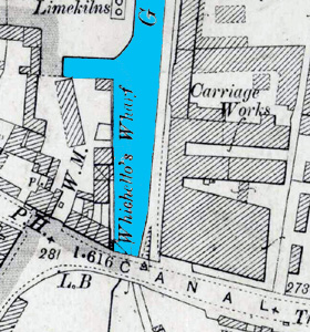
Site of Whichellos Wharf 1901
Reddall and Young's Wharf was in business by 1819 and lay on the west bank of the canal behind 24 Leighton Road and opposite the current [2008] Tesco supermarket and car park as seen on the map above from 1901. The wharf ended in a narrow basin at right angles more or less opposite where the supermarket now stands. Immediately north lay lime kilns.
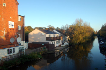
Site of Whichellos Wharf seen from Leighton Road bridge October 2008
The wharf later came to be known as Whichello's Wharf after Stephen Henry Whichello and Son, coal merchants. In 1905 Whichello's Wharf, then also known as Watkin's Wharf, was valued by Brown and Merry in Leighton Buzzard, it was described as: "The old established Canal Wharf with basin from the Grand Junction Canal adapted for the carrying on of a Wharfinger's Coal, Timber, Salt and General Builder's Merchant's Business, for which purpose there are the following convenient and well arranged buildings, viz".,
The site of Whichellos Wharf looking towards Leighton Road October 2008
"1. Brick and slated Office with weigh bridge adjoining.
2. Timber and slated Staffordshire Goods store.
3. Timber and slated timber store.
4. Brick and timber built coach-house and saddle room with lost over and large foaling box adjoining.
5. Range of brick and slated buildings, comprising Seven loose Boxes, and double Coach-house with loft over.
6. Timber built and slate shed with two boiling coppers, and two large foaling boxes and stable adjoining.
7. Range of timber built and iron roofed buildings consisting of cart shed and piggeries with loft over part.
8. Large timber storing shed.
9. Two large timber storing sheds with Slaughter house adjoining at one end and cart horse stable for 4 horses and forage store at other end.
10. Timber built and iron roofed Boat House.
11. Lime Kiln.
12. Timber and slated stable.
13. Large tiled timber storing shed.
14. Brick and slated 9 roomed cottage.
15. Covered Landing sage.
16. Lime and salt stores with loft over".
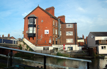
Rear of 24 Leighton Road June 2008
"The whole of the buildings are in a tenantable state of repair and judiciously erected for the purposes they are intended to serve. Beyond the Wharf are two small Paddocks of Grass Land. The total area of the Wharf with the above mentioned Paddocks is 3 acres or thereabouts". By the late 20th century the basin attached to this wharf had become infilled with reeds and mud".
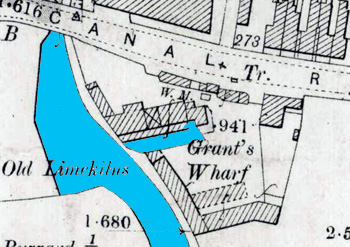
Site of Grant's Wharf 1901
South of Leighton Road on the east bank was the wharf of Grant and Lawson, later known as Brantom's Wharf. It probably dates back to the opening of the canal. This extended from the rear of Grand Union House to the canal.
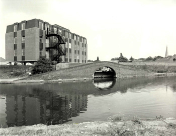
Towpath Bridge at Brantoms Wharf 1976 [Z50/74/6]
The wharf had a basin which, in 1974, was infilled to become a car park, though the hump-backed bridge, called the Towpath Bridge, was preserved through the efforts of Leighton Buzzard Preservation Society.
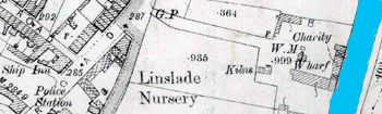
Site of Charity Wharf 1901
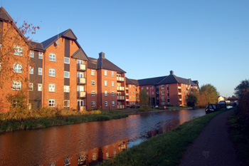
Charity Wharf also lay south of Leighton Road but on the west bank. It was so called because it originally formed part of the Wilkes Charity estate. It became a wharf in the late 19th century. At the time of writing [2008] the site is being used for a new housing development called, naturally, The Wharf.
Site of Charity Wharf seen from the opposite bank looking north October 2008
Three small wharves, called Railway Wharves lay south of the point at which the Leighton to Dunstable railway crossed the canal. They lay on the east bank opposite the modern Tiddenfoot Waterside Park and were used for loading sand and gravel quarried in the Grovebury and Billington Road areas and each was served by a narrow gauge railway
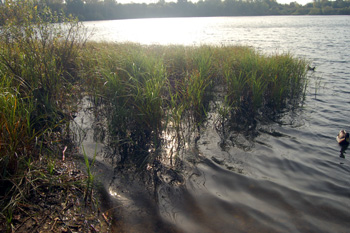
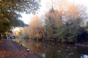
Reeds at Tiddenfoot Waterside Park October 2008
In 1926 the Regent's Canal Company bought the Grand Junction and three other Warwickshire canals. In 1929 the Grand Union Canal was formed from a merger of the Regent's Canal and a number of others. As can be seen from the returns of the various censuses the number of canal related workers employed rose and then fell as the canal lost importance following the growth of the rail network across the country:
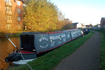
Trade barge opposite the site of Charity Wharf October 2008
As late as the 1960s the canal was used to transport such loads as coal, grain and steel. This finally came to an end due to tunnel closures in 1977-1978. The canal was then used for leisure purposes and the site of narrow boats used as dwellings. In recent years canal traffic seems to have increased and not all barges are used for pleasure as the photograph above shows. On an early morning trip to take photographs for this page in October 2008 upwards of a dozen boats lined the canal from the northernmost point of the site of Whichellos Wharf to the site of Charity Wharf around a quarter of a mile south, showing that the canal is probably nearly as heavily used now, at times, as it was two hundred years ago.