Linslade Maps
The parish of Linslade was never inclosed and it seems as if a map to accompany the Tithe Award of 1838 [P91/28/2] has either been lost or was never drawn up. Thus there are no 18th or 19th century maps held by Bedfordshire & Luton Archives & Records Service showing land ownership. The best evidence comes fro Ordnance Survey maps. It is possible that The Centre for Buckinghamshire Studies has earlier maps.
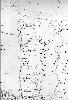
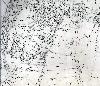
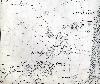
Most of the following maps are the second edition Ordnance Survey 25 inches to the mile maps published in 1901. To see a larger image please click on the relevant thumbnail.
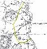
Bryant Map of Buckinghamshire of 1824 - Linslade boundary coloured yellow

Old Linslade in 1901
Northern part of Linslade in 1901

Central part of Linslade in 1901
Southern part of Linslade in 1901
Southcott in 1901