The Parish of Odell in General
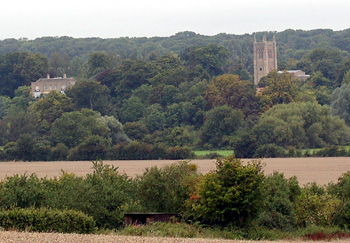
Odell Castle and church seen from Felmersham Road September 2008
Landscape
Odell lies in the valley of the River Great Ouse which, in fact, forms the southern boundary of the parish. Volume III of The Victoria County History for Bedfordshire, published in 1912 stated that the parish covered 2,902 acres of which 1,086 were used for arable farming, mostly wheat and 904.25 acres were permanent grassland.
Along the river the average height above sea-level is 145 feet. The church stands at just over 200 feet and Hobbs Green Farm just over 290 feet. The land rises as one goes north and Santa Pod, the race track of which is in the parish of Odell, is about 345 feet above sea-level.
The geology is complex. Along the river the solid, or underlying, geology is an interbedded limestone and clay mineral rock called Great Oolite Group laid down between 164 and 169 million years ago in the warm, shallow seas of the Jurassic Period. The village is built mostly on a limestone called Blisworth Limestone Formation, also laid down between 164 and 169 million years ago. A thin band of Blisworth Clay Formation, a mudstone laid down at the same time, lies north of the village with a wider band of cornbrash laid down between 159 and 169 million years ago north of that. Next comes a band of mudstone called Kelleways Clay Member, laid down between 159 and 164 million years ago. Next comes a band of sandstone called Kelleways Sand Member laid down at the same time as the mudstone. This includes the area of Hobbs Green Farm. Finally, north of that as far as the parish boudnary the bedrock is a mudstone called Oxford Clay Formation, laid down between 154 and 164 million years ago. Normally the soil reflects the soild geology, sand or clay but along the river is an alluvium of mixed sand, clay, silt and gravel, followed by a river terrace deposit of sand and gravel frther north as far as the main road through the village. Around Hobbs Green Farm and north of it is an area of diamicton known as Oadby Member formed in Ice Age conditions.
de Wahull coat of arms
Name
Odell is first mentioned in the Domesday Book of 1086 as Wadelle and Wadehelle, other variations include: Wahelle (1162); Wahull (1222-1428); Wahille or Waille (1240); Wadehulle (1276); Wodhull (1276-1428); Wahull or Wadhull (1304); Wodhill or Wodehill (1359-1476); Wodell (1485); Odyll or Odill (1494-1502); Wodhyl (1503). The first occurrence of the modern spelling is in 1526. The name means woad hill - clearly the plant which yielded the blue die so beloved of the Ancient Britons grew here in some profusion.
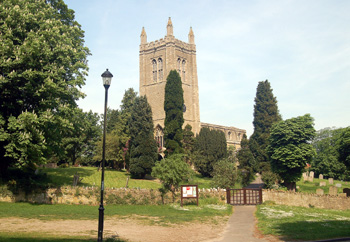
Odell Church from the south-west May 2008
Administrative History
Odell is an ancient parish bordered by Podington to the north-west, Sharnbrook to the north-east and east, Felmersham to the south-east, Carlton and Chellington to the south and Harrold to the south-west. The southern boundary of the parish is formed by the River Great Ouse. The hamlet of Little Odell in the west against the boundary with Harrold has been in existence since at least the 17th century, given the age of some of the properties and, in all likelihood, far longer.
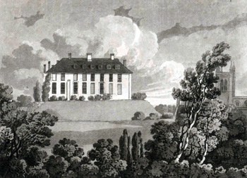
Odell Castle in 1811 by Thomas Fisher [X254/88/201]
Market
Odell is not the sort of parish which would instantly associate with a market. However, the Victoria County History, quoting documents held in the National Archives noted that in 1221 William FitzWarine paid a hundred shillings for the right to hold a market there. The following year a prohibition was placed on this right whilst it was investigated whether the market would be too much competition for that at Olney [Buckinghamshire]. It was proved that this would not be so and the market continued to be held, every Thursday, until at least 1236 when the right was confirmed to Baron and Lord of the Manor Saher de Wahull.
This goes to underline that fact that in the early Middle Ages Odell was of greater size and importance than neighbouring Harrold, which had a smaller population [see below] and did not obtain a market until the beginning of the 17th century. No doubt the existence of the castle and the Barony based on it had much to do with this.
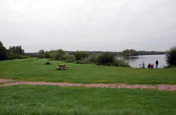
Harrold-Odell Country Park September 2008
Springs
The following is an entry from Oliver St.John Cooper's Historical Account of Odell of 1787: "Here is a great plenty of useful stone; lately discovered gravel; and several good springs, two of which have been reputed medicinal. One on the north-east, whose water has not been analyzed, yet well known to be mildly cathartic. That on the north-west has been so celebrated as to obtain the name of Holliwell for itself and two closes, through which it runs into the town". The gravel pits which, since they have been flooded, now form the heart of Harrold-Odell Country Park were exploited in ancient times. This reference by Cooper suggests that the modern pits may have first been exploited around the middle of the 18th century.
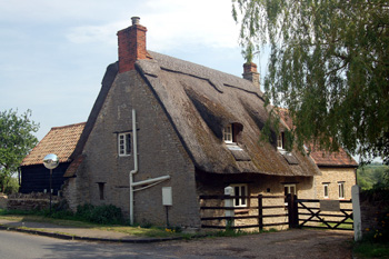
207 High Street May 2008
Population
At the time of Domesday Book in 1086 the two manors which comprised Odell contained together 16 villagers, 12 smallholders and 7 slaves; allowing for each of these having a family, as well as the households of the two Lords of the Manor this gives a total population of around 150 or more. This made Odell a comparatively populous place in 11th century Bedfordshire, far more so, in proportion to the rest of the county, than today. By way of comparison Harrold seems to only have had around fifty people at the same date.
The Hearth Tax of 1671 (transcribed in Bedfordshire Historical Records Society Volume 16 in 1934) records 66 dwellings in Odell for a total of 112 hearths. It has been estimated that this represented a population of about 280. The largest number - fourteen - were in Odell Castle. The house of William Elburrough contained a forge, clearly suggesting he was smith.
Volume 81 published by Bedfordshire Historical Records Society (2002) is devoted to returns made during the episcopal visitations to the county by the Bishop of Lincoln in the early 18th century, edited by former County Archivist Patricia Bell. One of the questions asked of the rector at each visitation was the number of families in the parish; the various responses were as follows:
- 1706: 60 families;
- 1709: 54 families;
- 1717: 66 families;
- 1720: 66 families
A very rough estimate of an average of four per family would give a population ranging from 216 to 264.
Bedfordshire & Luton Archives & Records Service has a document of 1729 [X117/5] listing all the males of the parish, their sons and servants over twelve years of age. There are 107 of them. This shows that, allowing for women, girls and boys under twelve the population of the parish must have been around 250. The names are as follows:
- Thomas Allin;
- John Amis senior;
- John Amis junior;
- Thomas Bailey;
- John Battison;
- William Betts;
- Thomas Bluffin;
- William Camper;
- Thomas Chapman;
- William Chapman;
- Henry Clark senior;
- Henry Clark junior;
- John Clark;
- Thomas Clark;
- William Clark;
- Edward Coalman;
- William Coock;
- Richard Cooper;
- William Cooper;
- Joseph Crouch;
- Henry Cumberland;
- Lawrence Cumberland;
- William Cumberland senior;
- William Cumberland junior;
- John Curtice;
- Richard Downing;
- Thomas Elmer;
- Robert Elson;
- John Eyles;
- William Eyles;
- Ralph Gearey;
- John Hardwick;
- Thomas Hardwick;
- Edward Harrison;
- Richard Harrison;
- Stephen Harrison;
- Thomas Harrison;
- Richard Hawkins;
- James Heartwell;
- Samuel Heartwell;
- William Heartwell;
- Francis Henman;
- Thomas Hewitt;
- George Hine;
- William Hine senior;
- William Hine junior;
- John Howkins;
- Henry Housman;
- William Housman;
- George Ives senior;
- George Ives junior;
- John Ives;
- John Jackson;
- Henry Jugerham;
- Robert Knight;
- William Knight;
- James Langley;
- James Langley;
- John Langley;
- Joseph Langley;
- Thomas Lawrton;
- William Lawrton;
- William Matthew;
- Thomas Matthew;
- John Moore;
- Daniel Odell;
- Thomas Pendrid;
- William Ridge senior;
- William Ridge junior;
- William Riseley senior;
- William Riseley junior;
- John Saunders;
- Robert Saunders;
- George Savage;
- Michael Sandy;
- Thomas Savage;
- William Savage senior;
- William Savage junior;
- Matthew Sharman;
- Philip Sharman;
- Robert Smith;
- William Spencer;
- John Sperey;
- Thomas Sperey senior;
- Thomas Sperey junior;
- John Talbott;
- John Talbott;
- Robert Talbott;
- Robert Talbott;
- Everet Tansley;
- John Tarry;
- Edward Tossill;
- Thomas Towler;
- William Vann;
- Isaac Watford;
- Thomas Watford senior;
- Thomas Watford junior;
- William Watford;
- William Wersley;
- Isaac Willamott;
- John Willamott;
- Thomas Willamott;
- Thomas York;
- Demetrius Young;
- Isaac Young;
- John Young
Census records show the population of Odell shrinking greatly around the turn of the 19th and 20th centuries and then remaining relatively stable at about the same numbers as in the early 18th century. This decline was, presumably, due to the drift of jobs away from the land and farming, meaning people had to move away to secure employment.
- 1801: 361;
- 1811: 368;
- 1821: 439;
- 1831: 475;
- 1841: 501;
- 1851: 538;
- 1861: 494;
- 1871: 485;
- 1881: 422;
- 1891: 388;
- 1901: 281;
- 1911: 252;
- 1921: 223;
- 1931: 226;
- 1951: 235;
- 1961: 241;
- 1971: 273;
- 1981: 258;
- 1991: 249;
- 2001: 259;
- 2011: 287.
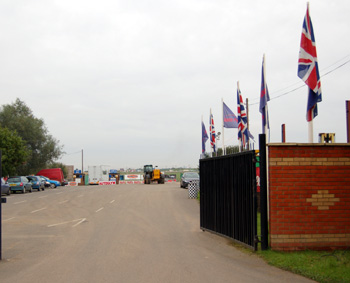
Entrance to Santa Pod September 2008
Santa Pod
Bedfordshire & Luton Archives & Records Service has no material on Santa Pod itself, however the site's history is well known. It is built on a World War Two airfield which opened in 1942 and closed in 1946. It was built for the Royal Air Force but was handed to the United States Army Air Force and was used by 92nd, 100th and 301st Bomb Groups. The field included a control tower, hangars, barracks, administration buildings, bomb stores and ammunition dumps. The site has been used since 1966 for drag racing, the main runway being resurfaced for it in 1972. Despite being known as Santa Pod none of site is in Podington - many of the buildings are in Sharnbrook and most of the drag strip is in Odell.

92nd Bombardment Group memorial at Hinwick September 2008