Odell Before 1086

A cow at Harrold-Odell Country Park - cattle have been domesticated since the Neolithic Period
Before the Romans
The earliest known evidence of human habitation in what is now the parish of Odell comes in the form of flints dated to the Mesolithic era. These were excavated at the Romano-British farm at Harrold-Odell Country Park noted below. A site just over the parish boundary in Harrold revealed Bronze Age occupation and crop-marks have shown Bronze Age ring ditches in Odell itself between Odell Lodge and the River Great Ouse [National Monument Record [NMR] Number 346825].
Odell was clearly well settled by the time of the Iron Age as activity has been found at a number of spots. A D-shaped enclosure just south-west of Antonie Spinney on the boundary with Sharnbrook near Colworth House has been identified by aerial photography [NMR1458361]. Early Iron Age pottery has been found in the northern part of Forty Acre Wood near the boundary with Podington and there was clear evidence of Iron Age settlement of the Romano-British farm site in Harrold-Odell Country Park [NMR347160].
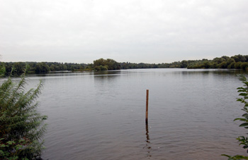
The main lake at Harrold-OdellCountry Park September 2008
Romano-British Odell
The best recorded ancient site in Odell is the Romano-British farm excavated by Brian Dix in the 1970s in an old gravel quarry, now part of Harrold-Odell Country Park. The settlement extended back into the late Iron Age with a 1st century AD enclosure of huts. Wells, quarry pits and two cremations dated to this period. Between about 70 and 150 AD a trapezoidal enclosure was erected in fields to the east of the first settlement. Following this the field boundaries were re-dug and a large number of quarry pits for stone and gravel dug [NMR346820].
Another Romano-British settlement has been identified between Antonie Spinney and Louse Acre Wood near the boundary with Colworth in Sharnbrook. This site covers six acres and contains a scatter of building stone, roof tiles and pottery. It either continued to be occupied or was reoccupied later as a settlement and moat existed here in the 13th century, as identified by pottery. It has been suggested, due to the nature of the Romano-British pottery found, that the site may have been a Roman villa in the 3rd and 4th centuries [NMR346800].
Pottery, tiles and scattered slag, limestone and pebbles also indicate a Romano-British settlement just inside Odell parish just south of Westwood Farm on the modern Odell Road [NMR 346815]. A further Romano-British site has been identified from limestone and slag just east of Church Lane between Hobbs Green Farm and Numbers 50 and 52 [NMR346817]. Romano-British pottery has been found north of the road to Sharnbrook between Odell Lodge and the sewage works [NMR346829].
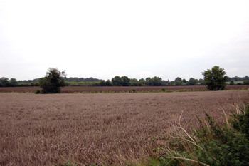
Area of Romano-British pottery finds NMR346829 September 2008
Dark Ages
The period from the end of Roman occupation until the Norman Conquest is known as the Dark Ages due to the supposed shortage of written evidence. Archaeology is also in short supply in Odell although it seems as if the Romano-British farm in Harrold-Odell Country Park continued to be occupied until at least the early 8th century as two Saxon wells were dug