Ickwell Maps
The following maps are only a selection of those held at Bedfordshire and Luton Archives and Records Service. The map below is of Ickwell taken from the inclosure map for Norhill on 1783 [MA2] in which the top of the map is east, rather than north. To see a larger version please click on the image.
![Ickwell on the Northill inclosure map of 1783 [MA2]](/CommunityHistories/Ickwell/IckwellImages/Ickwell on the Northill inclosure map of 1783 [MA2_303x300.jpg)
Ickwell on the Northill inclosure map of 1783 [MA2]
The maps below are taken from Ordnance Survey 25 inches to the mile sheets - the 1st edition of 1883 and the third edition of 1926. Again, to see a larger version, please click on the relevant image.
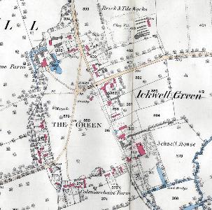
Ickwell Green in 1883
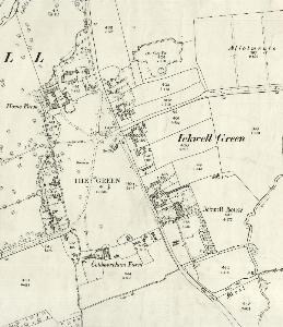
Ickwell Green in 1926
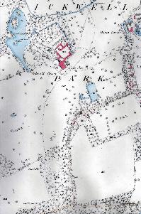
Ickwell Park and Warden Road in 1883
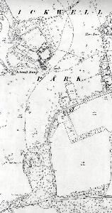
Ickwell Park and Warden Road in 1926