Cople Maps
The following maps are only a selection of those held at Bedfordshire Archives. To see a larger image of each map, please click on the relevant thumbnail
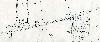
Cople in 1779 [ref: R1/20]
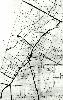
Ordnance Survey 25 inches to the mile second edition map for the main part of the village - 1901
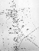
Ordnance Survey 25 inches to the mile second edition map for the northern part of the village - 1901