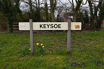
The Community of Keysoe in General
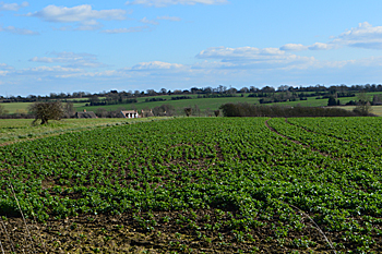
View south from the church February 2016
Landscape
Keysoe lies on a bedrock geology of Oxford Clay, a mudstone laid down between 154 and 164 million years ago in the warm, shallow seas of the Jurassic Period. Sub-soils include Oadby Member at Keysoe Row – a diamicton laid down in Ice Age conditions in the last two million years; alluvium along Keysoe Brook – clay, silt, sand and gravel; glaciofluvial deposits of sand and gravel in the northern part of London End and river terrace deposits of sand and gravel around the Green.
The church is 247 feet above sea-level and the junction of Church Road with Kimbolton Road at 221 feet. Keysoe Row Baptist chapel lies at 259 feet above sea-level.
Name
The Place Names of Bedfordshire and Huntingdonshire by A Mawer and F M Stenton 1926 states that the name means “Cæg’s spur of land”. The following variatons have been identified over time:
- Chaisot: 1086;
- Caissot: 1086;
- Chaishou: 1167-1176;
- Kaisho: 1195-1267
- Kaiso: 1195-1267;
- Caysho: 1219-1490;
- Cayshou: 1219-1490;
- Kaysho: 1219-1490;
- Kayshou: 1219-1490;
- Kaissow: 1219;
- Keysho: 1227;
- Caysho: 1247-1296
- Cayesho: 1247-1296;
- Kayso: 1276-1295;
- Cayso: 1276-1295;
- Gayso: 1287;
- Kaiesho: 1317;
- Cayshoo: 1368;
- Cayssho: 1390-1392;
- Caysthoo: 1421;
- Keisoo: 1579;
- Caishoe: late 16th century;
- Caishow: 1647;
- Casoe: 1767
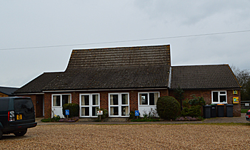
The Village Hall March 2016
Administrative History
Keysoe is an ancient parish in the Stodden Hundred. It is surrounded by Pertenhall to the north, Little Staughton to the east, Bolnhurst to the south-east, Thurleigh to the south-west, Riseley to the west and Swineshead to the north-west. In 1934 the civil parish was merged with that of Bolnhurst to form the new civil parish of Bolnhurst and Keysoe.
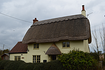
Summer Song March 2016
Population
The Domesday Book of 1086 records nine villagers, six smallholders and one slave in Keysoe. This gives a total population of sixteen. As this number represents the heads of household, to get an idea of the total population it is probably necessary to multiply this figure by a factor of at least four suggesting a total population to somewhere around 64.
Censuses from 1801 give the following population figures. Figures from 1951 are those for the modern civil parish of Bolnhurst and Keysoe:
- 1801: 370;
- 1811: 502;
- 1821: 649;
- 1831: 718;
- 1841: 757;
- 1851: 834;
- 1861: 867;
- 1871: 879;
- 1881: 710;
- 1891: 662;
- 1901: 525;
- 1911: 504;
- 1921: 450;
- 1931: 432;
- 1951: 588;
- 1961: 583;
- 1971: 588;
- 1981: 639;
- 1991: 667;
- 2001: 732;
- 2011: 719.