The Parish of Steppingley in General

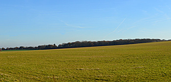
Flitwick Wood seen from Flitwick Road 1st December 2016
Landscape
The village of Steppingley lies on a solid geology known as Woburn Sands Formation, a claystone laid down between 99 and 121 million years ago in the warm, shallow seas of the Cretaceous Period. The area around Steppingley Hospital lies on a solid geology of West Walton Formation and Ampthill Clay Formation, a mudstone laid down between 154 and 159 million years ago in the Jurassic Period. The soil is mostly sandy in nature.
The church stands 343 feet above sea-level. The ground slopes down to the east, the Drovers Arms being at 311 feet and Steppingley Hospital 253 feet above sea-level.

Name
Steppingley is a combination of the Old English name Steapa and the Old English words “ingas” and “leah”, meaning “people of” and “valley”, hence Valley of Steapa’s People. The name has changed over the years as the following list shows:
- Stepigelai - 1086;
- Stepingelea - 1167;
- Stepingele - 1202-1302;
- Stepingeley - 1202-1302;
- Steppingele - 1202-1227;
- Steppingelegh - 1202-1227;
- Stepyngle - 1202-1433;
- Stepingle - 1202-1433;
- Stebbingele - 1214-1227;
- Stebbingelegh - 1214-1227;
- Stebbingle - 1240;
- Steppingle - 1242-1323;
- Stypingle - 1405.

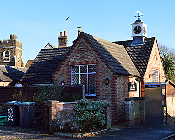
The Village Hall December 2016
Administrative History
Steppingley is an ancient parish in the Redbornestoke Hundred. It is surrounded by Millbrook to the north, Ampthill on a small part of the northern boundary, Flitwick to the east and south-east, Eversholt to the south and Ridgmont to the west.
![Roundabout outside the French Horn about 1900 [X431/1]](/CommunityHistories/Steppingley/X431-1350x250.jpg)
Roundabout outside the French Horn in 1870 [X431/1]
Population
The Domesday Book of 1086 tells us that Steppingley was inhabited by fourteen villagers and two slaves. These would have been heads of household and to arrive at a guesstimate of the total figure one should probably multiply this by a factor of at least four, suggesting a population of around 64. Censuses for England have been taken since 1801 and the population figures for Steppingley are as follows:
- 1801: 264;
- 1811: 285;
- 1821: 323;
- 1831: 348;
- 1841: 377;
- 1851: 404;
- 1861: 365;
- 1871: 352;
- 1881: 313;
- 1891: 308;
- 1901: 273;
- 1911: 254;
- 1921: 264;
- 1931: 247;
- 1951: 221;
- 1961: 243;
- 1971: 214;
- 1981: 235;
- 1991: 220;
- 2001: 234;
- 2011: 236