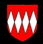
The d'Aubigny family coat of arms
The Victoria County History for Bedfordshire, traced the histories of the various manors in the county. Volume II, including Pulloxhill, was published in 1908. In 1086 the Domesday Book recorded that all Pulloxhill formed just one manor which was held by Nigel d'Aubigny who had two tenants named Roger and Rhiwallon. All the later manors in Pulloxhill can trace their history back to this holding.
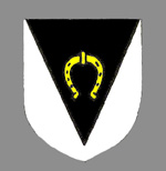
The arms of Dunstable Priory
Beeches Manor originated in estates held in Pulloxhill by Dunstable Priory under the overlordship of the d'Aubignys' Barony of Cainhoe. The priory had five hides, half the 1086 manor of Pulloxhill, in 1285 and leased it to the Pyrot family. By 1302 the priory's holding had been halved and remained at that figure until at least 1428.
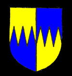
The Pirot family coat of arms
Following the dissolution of the priory in 1540 the lands were taken by the Crown and granted, it would seem, to Simon Fitz of Aspley Guise who died holding the Manor of Beeches in 1543. His eldest son and heir died two years later and the manor descended to his brother Simon. In 1552 the Manor of Upbury was first mentioned in connexion with Beeches, its origin is unknown.
By 1567 Thomas Morgan had acquired Beeches and Upbury and settled them on George Fitz alias Wharton when Fitz married Ann, eldest daughter of Peter Duckett, Lord of the Manor of Pulloxhill and Greenfield. The manors are last mentioned in 1700 when John Coppin was Lord. He also held Pulloxhill and Greenfield and, like them, conveyed Beeches and Upbury to the Duke of Kent in or around 1710. No separate mention is ever made of the manors again and so it seems they were absorbed into the manors of Pulloxhill and Greenfield.
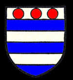
The de Grey family coat of arms
The Bedfordshire Historic Environment Record [HER] contains information on the county's historic buildings and landscapes and summaries of each entry can now be found online as part of the Heritage Gateway website. There are moats at Gagmansbury Farm [HER 244]. The HER describes them thus: "A complex moated site near Pulloxhill village. The site consists of the remains of the manor of Upbury, comprising a central moated enclosure within a complex of ditches defining outer wards and including a series of fishponds. The central moated enclosure is rectangular in plan and measures 55 metres by 38 metres and is surrounded by a partly water filled ditch averaging 10 metres wide and 2 metres deep, with a causeway in the south-eastern side which is thought to be the original entrance. Another causeway in the north-eastern side is of modern construction. The interior of the island shows some undulations thought to be the locations of buildings; an estate map of 1768 [L33/32] depicts a building on the north eastern edge of the island, and another map of 1820 shows further buildings in the northern corner and near the original entrance. Blocks of squared sandstone are recorded as being found in the pond just outside the central enclosure".
"A larger moated enclosure lies to the north, east and south of the central enclosure, and is shown subdivided into northern and southern parts on the 1768 map. The whole enclosure measures approx 200 metres by 120 metres and its surrounding ditches are of a similar size to those of the central enclosure. The northern part is further divided by a low bank, to the north-west of which are the remains of ridge and furrow earthworks and to the south-east are low earthworks thought to indicate building platforms and yards".
"A third enclosure lies to the west of the central moated site and measures 100 metres by 50 metres; on the 1768 enclosure it is named "The Great Orchard". To the south and south-west of the largest enclosure is a series of ponds and channels, some of which form a small square enclosure 35 metres across which is named as "The Little Orchard" on the 1768 map. As with the larger enclosure ditches, the ponds and channels are partly water-filled. An early 19th century draft enclosure map records a field name of Dovehouse Close to the south-west of the site, which may indicate the presence of a dovecot".
"The central enclosure is thought to be the earliest part of the site, dating from the 12th century, with the other features developing during the 13th and 14th centuries. The name Upbury may derive from the Anglo-Saxon personal name "Hutta" and the term "burh" meaning an enclosure or defended setttlement, which suggests that there may have been occupation on the site before the 12th century".