Deserted Medieval Villages Around Pulloxhill
The Bedfordshire Historic Environment Record [HER] contains information on the county's historic buildings and landscapes and summaries of each entry can now be found online as part of the Heritage Gateway website. The HER identifies four deserted medieval village sites which have been, at some time, in the civil parish of Pulloxhill.

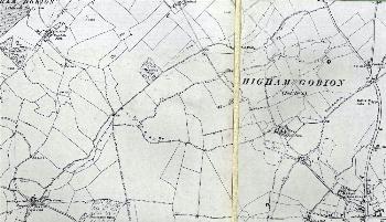
Faldo on a map of 1901 - to see a larger version please click on the image
The site of the medieval village of Faldo [HER 241] is today indicated by earthworks. It was in a detached part of the ancient parish of Higham Gobion until 1933 [MDCP54/6/1/1] and since 1984 has been in the civil parish of Barton-le-Clay [CDP81]. It lies north-west of Barton-le-Clay. Building plots, sunken ways, a probable fish pond and a possible moated site have been observed. Some of the area has been ploughed, and pottery and other finds retrieved after ploughing in the 1950s are now in Luton Museum.

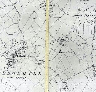
Deserted medieval villages on a map of 1901 - to see a larger version please click on the image
Kitchen End [HER 17015] lies south-east of the village of Pulloxhill along Barton Road. The name [HER 787] is suggested as early Anglo-Saxon. In the 13th century it appears as Kechyng or Kechinge, and may derive from Cyccingas, the place of the followers of Cuca. The well-documented medieval manor is therefore thought to have originated as an early Anglo-Saxon settlement. Further remains are visible just south of Kitchen End Farm [HER 1488]. These earthworks are thought to be the remains of a deserted settlement. The field in which they occur is named "Floating Meadow" on the draft Inclosure map c.1809-1826 [MA56], and has a possible watercourse along its northern boundary. It is possible that the field was a water meadow, used to provide early grazing for sheep.
The medieval settlement of Gagmansbury [HER 17014] is located to the south of an area of manorial earthworks, the site of the mansion house of the Manor of Upbury. The settlement lies due east of the northernmost point of the village of Pulloxhill at the northern end of a lane passing Hillfoot Farm.
Linear and rectilinear earthworks have been recorded from aerial photographs north of Pulloxhill [HER 1825]. They probably represent a shrunken area of medieval settlement. Some of the earthworks coincide with field boundaries shown on the Draft Enclosure Map (c.1809-1826) [MA56], and appear to overlie earlier features. Limited archaeological work in the area has identified prehistoric activity. Ridge and furrow marks are also visible [HER3322]. The settlement may be the "Townys End" referred to in a will of 1505; to the south of the site is Town Farm.