The Parish of Pulloxhill in General
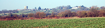
View towards the village from Kitchen End March 2011
Landscape
Volume II of The Victoria County Historyfor Bedfordshire published in 1908, before the various boundary changes of 1933 and 1984 (see below) measured the parish at 1,627 acres of which 510 acres, 1 rood were arable land and 953 pasture. The principal crops were wheat, barley, beans and peas.
The highest point of the parish is a Higham Bury which lies 362 feet above sea-level; the area of the village around the church is only slightly lower at 342 feet. The lowest part of the parish is around Kitchen End which lies at 187 feet.
The solid, or underlying, geology of the parish, including the village, is a mudstone described as Gault Formation, laid down between 99 and 112 million years ago in the warm, shallow seas of the Cretaceous Period. Around Portobello Farm the solid geology changes to a chalk known as West Melbury Marly Chalk Formation laid down between 95 and 99 million years ago.
The village has a superficial geology of a diamicton known as Lowestoft Formation, laid down during the Ice Ages. There are glaciofluvial deposits laid down in the mid Pleistocene Epoch where Sand Lane meets the A6.
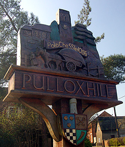
New Pulloxhill sign March 2011
Name
The name Pulloxhill may include a personal name of Pulloc or something similar, so the name might mean simply Pulloc's hill. The name has had the following variations over the years:
- Polochessele: 1086;
- Pollockeshill: 1205-1287;
- Pollukeshull: 1214;
- Pulocheshalla: early 13th century;
- Bulluckeshulle: 1227;
- Pollokeshull: 1228-1337;
- Pullokeshull: 1242-1392;
- Bolokeshill: 1276;
- Pullukeshull: 1286;
- Poleshill: 1287;
- Pullockeshill: 1287;
- Pollekeshull; 1337;
- Pollexhulle: 1428;
- Polloxhulle: 1428;
- Polluxhull: 1526;
- Poloxhill: 1577;
- Pullockshill: late 16th century.
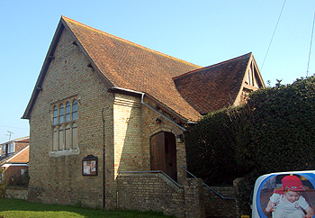
The Hall in Church Road March 2011
Administrative History
Pulloxhill is an ancient parish though its boundaries have changed significantly over the years. The parish used to have a detached area around Greenfield Mill, wholly surrounded by the parish of Flitton but this was transferred to Flitton in 1933 [CDP55].
Pulloxhill used to extend north-west to include all the properties on the south side of the High Street and the south side of the west end of Flitton Road in Greenfield. This area was transferred to the new civil parish of Flitton and Greenfield in 1984 [CDP82]. Oak Drive and Maple Close in Greenfield remain in the parish of Pulloxhill at the present time [2011], however.
In 1933 two detached portions of the parish of Higham Gobion were absorbed into Pulloxhill. The largest of these was to the south and south-east of the parish and included Faldo Farm and the Speed the Plough Public House. The smaller area was around Higham Bury [MDCP54/6/1/1]. Part of the first named area, that around Faldo Farm was transferred to Barton-le-Clay in 1984 [CDP81].
Pulloxhill used to be bordered north and east by Flitton, south-east by a detached part of Higham Gobion, south-west by Streatley and another detached part of Higham Gobion, east by Greenfield and north east by another detached part of Higham Gobion. Pulloxhill is now much bigger in size and its modern boundaries are with Silsoe to the north-east and east, Barton-le-Clay to the south-east, Streatley and Harlington to the south-west, Greenfield to the west and Flitton to the north.
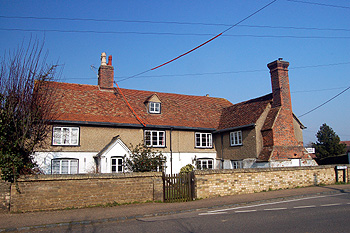
Town Farmhouse March 2011
Population
The Domesday Book of 1086 records 26 people in Pulloxhill. These are just the heads of households and so the figure must be multiplied by a factor of at least four, suggesting just over a hundred people. The population of Pulloxhill rose steadily during the 19th century, more than doubling between 1801 and 1861 then, as people had smaller families and began to leave the land in favour of life and work in towns it declined again to nearly 1801 levels by 1921. Since 1951 the population has doubled again as new housing developments have been built, though figures were remarkably stable for the last three decades of the 20th century. The figures below are taken from census returns.
- 1801: 317;
- 1811: 408;
- 1821: 475;
- 1831: 529;
- 1841: 611;
- 1851: 688;
- 1861: 704;
- 1871: 625;
- 1881: 529;
- 1891: 492;
- 1901: 395;
- 1911: 419;
- 1921: 374;
- 1931: 398;
- 1951: 403;
- 1961: 648;
- 1971: 844;
- 1981: 878;
- 1991: 729;
- 2001: 845;
- 2011: 985.