Oakley Maps
The following maps are only a selection of those held at Bedfordshire and Luton Archives and Records Service.
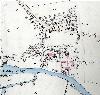
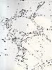
The map below shows the extent of the Manor of Oakley Reynes in 1737 when it was purchased by the Duke of Bedford. This, in effect, meant the virtually the whole village and parish. To see a larger version please click on the image
![Oakley in 1737 [R1-37]](/CommunityHistories/Oakley/OakleyImages/Oakley in 1737 [R1-37]_91x100.jpg)
Oakley in 1737 [R1/37]
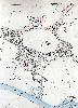
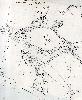
The map below was drawn up when Oakley was inclosed. To see a larger version please click on the image.
![Oakley Inclosure Map of 1804 [MA72]](/CommunityHistories/Oakley/OakleyImages/Oakley Inclosure Map of 1804 [MA72]_81x100.jpg)
Oakley Inclosure Map of 1804 [MA72]
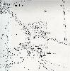
The maps below are from the Ordnance Survey 25 inches to the mile first edition maps for Oakley. To see a larger version, please click on the image.
The area around the church in 1883
The southern part of the village in 1883
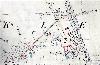
The northern part of the village in 1883
The maps below are from the Ordnance Survey 25 inches to the mile second edition maps for Oakley. To see a larger version, please click on the image.
The area around the church in 1901
The southern part of the village in 1901

The northern part of the village in 1901
The maps below are from the Ordnance Survey 25 inches to the mile third edition maps for Oakley. To see a larger version, please click on the image.

The area around the church in 1926
The southern part of the village in 1926

The northern part of the village in 1926