Elstow Maps
To see a larger version of each map please click on the relevant image.
![X1-6-1 1767](/CommunityHistories/Elstow/ElstowImages/X1-6-1 1767_243x300.jpg)
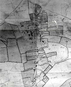
Part of an estate map of Elstow Manor of 1767 [X1/6/1]
![The northern part of the village in 1884](/CommunityHistories/Elstow/ElstowImages/The northern part of the village in 1884_351x257.jpg)
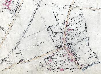
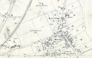
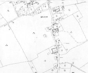
Ordnance Survey 25 inches to the mile 1st edition map showing the northern part of the village - 1884
![OS 155 Elstow 1st ed pt1](/CommunityHistories/Elstow/ElstowImages/OS 155 Elstow 1st ed pt1_349x273.jpg)
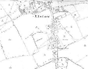
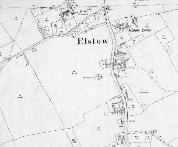
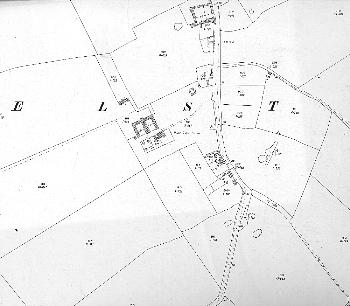
Ordnance Survey 25 inches to the mile 1st edition map showing the southern part of the village - 1884
![OS 155 Elstow 1st ed pt2](/CommunityHistories/Elstow/ElstowImages/OS 155 Elstow 1st ed pt2_284x300.jpg)
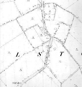
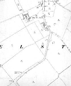
Ordnance Survey 25 inches to the mile 1st edition map showing the area around Pear Tree Farm - 1884
![The northern part of the village in 1901](/CommunityHistories/Elstow/ElstowImages/The northern part of the village in 1901_351x223.jpg)
Ordnance Survey 25 inches to the mile 2nd edition map showing the northern part of the village - 1901
![OS 155 Elstow 2nd ed pt1](/CommunityHistories/Elstow/ElstowImages/OS 155 Elstow 2nd ed pt1_350x289.jpg)
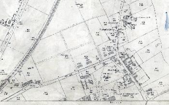
Ordnance Survey 25 inches to the mile 2nd edition map showing the southern part of the village - 1901
![OS 155 Elstow 2nd ed pt2](/CommunityHistories/Elstow/ElstowImages/OS 155 Elstow 2nd ed pt2_248x301.jpg)
Ordnance Survey 25 inches to the mile 2nd edition map showing the area around Pear Tree Farm - 1901
![The northern part of the village in 1926](/CommunityHistories/Elstow/ElstowImages/The northern part of the village in 1926_350x218.jpg)
Ordnance Survey 25 inches to the mile 3rd edition map showing the northern part of the village - 1926
![OS 155 Elstow 3rd ed pt1](/CommunityHistories/Elstow/ElstowImages/OS 155 Elstow 3rd ed pt1_350x289.jpg)
Ordnance Survey 25 inches to the mile 3rd edition map showing the southern part of the village - 1926
![OS 155 Elstow 3 ed pt 2](/CommunityHistories/Elstow/ElstowImages/OS 155 Elstow 3 ed pt 2_350x306.jpg)
Ordnance Survey 25 inches to the mile 3rd edition map showing the area around Pear Tree Farm - 1926