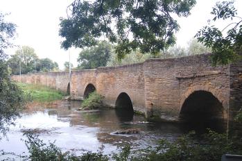
Bromham Bridge September 2007
Bromham Bridge is, for a large part of its length, actually in the parish of Biddenham, the parish boundary running along the eastern bank of the River Great Ouse. It has 26 arches. It looks at first glance to be of medieval origin. It is, however, largely a product of the rebuilding of 1813 though a bridge had existed since the early Middle Ages. Bedfordshire & Luton Archives & Records Service has a piece of research by office staff giving a brief history of the bridge [CRT130BRO7].
The first known reference to it is in the Pipe Rolls for 1224 and again in 1227/8 where a piece of land is noted as bounding "Wuluescroft towards the bridge of Biddenham", an adjoining cottage was occupied, appropriately, by Hugh de Ponte or "Hugh Bridge". The Dunstable Chronicles state that after a long spell of freezing weather in 1281 the bridge collapsed, a woman falling into the river and being carried as far as Bedford Bridge "where she was seen no more".
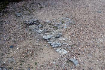
Possible remains of the chantry in front of the Miller's House September 2007
A chantry chapel existed at the bridge where a priest prayed for the soul of the founder and collected alms to go towards keeping it in repair. This chantry was suppressed by Henry VIII in 1545 though it was not until the reign of his son Edward VI that it was assessed for value: its last incumbent had been a Frenchman named Peter Weyver. By this time the chantry owned a number of nearby cottages and strips of land as well as a more substantial farm in Kempston, Biddenham and Bromham. Quarry pits in Bromham were also owned from which, of course, the stone was taken to keep the bridge in repair. The chantry was finally closed in 1553 and Weyver was given a pension of £5 per year. The Willey Hundred states that at the time of publication, 1870, the remains of the chantry were still visible in the miller's house on the Bromham side of the river but Volume III of the Victoria County History notes that this house was pulled down and replaced before publication of that volume in 1912.
Bedfordshire & Luton Archives & Records Service has records indicating repairs to the bridge at various dates, the earliest being in 1651 [TW841]. The bridge was repaired again in 1685 as noted in the Assize records [HSA1686S6], the latter being borne out by an inscription on the bridge itself recording the fact, the cost was over £230, a very large sum indeed for that time. The bridge seems to have been repaired again in 1724 since the parish records speak of "gathering up the Coping Stones out of the river" and using nearly a hundred loads of stones. Minor repairs are recorded in 1738, 1742 and 1752. A thorough repair of the wider part of the bridge in 1791 included "Takeing Down all the Bad Places and Repairing Throuout". The next year it was presented at Quarter Sessions that "the Horseway and Footway Bridge" was in "great decay".
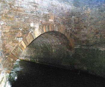
Bromham Bridge arch September 2007
The bridge was widened in 1813, taking its present 26 arch form, the width being increased from 6ft over the flood plain and 11ft 6in over the river itself. The 6ft stretch was for horses and people on foot, the wider stretch, approached by a separate road from Biddenham, for carts. The architect responsible for the rebuilding was Robert Salmon and the parish archive contains references to cutting stone for the task [P67/28/2]. The main arches over the river were again widened and rebuilt in 1902.
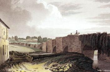
Thomas Fisher's painting of Bromham Bridge in 1812, just before reconstruction and widening
A description in the Turvey parish register from 1630 describes the bridge as having 25 arches, three high arches in Bromham and a double high arch in Biddenham, presumably those over the river itself, the "long bridge", presumably that 6 feet wide over the flood plain, having 20 arches.