The Parish of Wootton in General

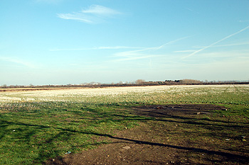
Looking from Potters Cross north-east March 2012
Landscape
Wootton has a solid, or underlying, geology known as Peterborough Member, a mudstone, laid down between 154 and 164 million years ago in the warm, shallow seas of the Jurassic Period. Bourne End, Hall End, Keeley Lane and the south-western part of Church End all have a solid geology of Oxford Clay, laid down at the same time.
Not surprisingly the superficial geology overlying this is a clay soil, though Hall End, Keeley Lane, and the south-western part of Church End are covered in a mixture of gravel, sand, silt and clay known as Head which formed in the last two million years. Bourne End has a type of soil known as till, glacial in origin and formed during the Ice Ages, it is a type of diamicton.
Wootton, close to the River Great Ouse and in the Clay Vale of Bedford, is a relatively low-lying place. The church stands at 165 feet above sea-level. Wootton Upper School is two feet higher and the , appropriately enough, quite a bit lower at 127 feet. The highest part of the parish, Bourne End, rises to around 300 feet above sea-level.

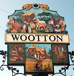
The Wootton sign March 2012
Name
The name, a common one in England, comes from two Anglo-Saxon words “wudu” and “tun”, meaning “wood” and “farm” respectively. The name has had a number of variations over the years as the list below demonstrates:
- Otone: 1086;
- Wutton: 1197-1397;
- Wotton: 1223 and thereafter;
- Wuttun: 1317;
- Woutton: 1304.

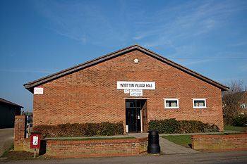
Wootton Village Hall March 2012
Administrative History
Wootton is an ancient parish in the Rebornstoke Hundred. The boundary of the civil parish changed in 1937 when a large area amounting to 1,339 acres, including the hamlet of Wootton Pillinge, was transferred to the new civil parish of Stewartby. The parish of Wootton is bounded by: Kempston Rural to the north; Stewartby to the east; Marston Moretaine to the south and Cranfield to the west. The village itself includes the following ends: Church End to the south; Bott End to the north-east; Hall End to the west; Mount Pleasant to the north-east and Keeley Green to the north.
The village of Wootton lies in the north-east of the parish. The hamlet of Bourne End lies in the north-west of the parish and the hamlet of Wootton Green in the south and is divided between the civil parishes of Wootton and Cranfield. This southern boundary with Cranfield is also the boundary between the unitary councils of Bedford Borough and Central Bedfordshire.
![Bedford Road and the Cock about 1918 [Z50/136/4]](/CommunityHistories/Wootton/WoottonImages/Bedford Road and the Cock about 1918 Z50-136-4.jpg)
Bedford Road and the Cock about 1918 [Z50/136/4]
Population
The number of people in Wootton in 1086 is recorded as twenty six. These would have been the heads of household and to reach an estimate of the total population one should multiply this by a factor of at least four, suggesting a population slightly in excess of a hundred, a good sized community for the date.
Wootton has always been a large village for its time. Remarkably, it did not suffer the great decrease in population in the latter quarter of the 19th and early part of the 20th centuries experienced by so many Bedfordshire villages as people left the land for jobs in towns during and after the Great Agricultural Depression which lasted from 1873 to 1896. This may be because Bedford and Kempston were in easy reach of Wootton allowing people to live in one and work in the other.
- 1801: 732;
- 1811: 831;
- 1821: 944;
- 1831: 1,051;
- 1841: 1,122;
- 1851: 1,204;
- 1861: 1,349;
- 1871: 1,312;
- 1881: 1,302;
- 1891: 1,253;
- 1901: 1,252;
- 1911: 1,394;
- 1921: 1,347;
- 1931: 1,551;
- 1951: 1,330;
- 1961: 1,826;
- 1971: 2,835;
- 1981: 3,478;
- 1991: 3,693;
- 2001: 4,235;
- 2011: 4,156.