The Parish of Cardington in General

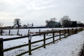
View from Southill Road towards RAF Cardington Christmas Eve 2010
Landscape
Cardington lies in the flood plain of the River Great Ouse, except near the boundary with Old Warden at the south-east where it lies on a clay escarpment. It is comparatively low-lying, the highest point near the Old Warden boundary being 276 feet above sea level but the church stands at just 95 feet and Cardington Bridge at 85 feet.
The solid, or underlying geology is Oxford Clay, a mudstone laid down between 154 and 164 million years ago in the Jurassic Period in warm, shallow seas. The superficial geology in the village, not surprisingly given its proximity to the River Great Ouse, is a river terrace deposit of sand and gravel.

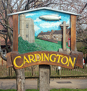
Cardington sign March 2011
Name
The name Cardington seems to mean, according to A. Mawer and F. M. Stenton “farm of the people of Cærda” though the personal name is far from certain. The Oxford Dictionary of English Place Names interprets the personal name as Cenred. At any rate this person, whatever their name, had followers who established a farm in the vicinity!
The name has undergone a number of changes over the years. These are detailed below:
- Chernetone: 1086;
- Kerdinton: c. 1190-1428;
- Kerdynton: c. 1190-1428;
- Kardinton: 1220-1227;
- Kerdintuna: 1304;
- Cherdyntona: 1317;
- Kerdington: 1247-1428;
- Kerdyngton: 1247-1428;
- Kerenton: 1286;
- Kerynton: 1286;
- Kardington: 1287-1440;
- Cardyngton: 1287-1440;
- Carington: 1535-1549;
- Careington: 1638.

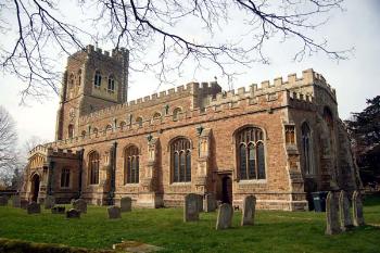
Cardington church from the south-east March 2007
Administrative History
Cardington is an ancient parish. The hamlets of Harrowden, Cotton End and Fenlake formed part of Cardington until 1866 when they were formed into a separate civil parish called Eastcotts, though remaining in the Church of England parish of Cardington (except for a small portion transferred to the new parish of Saint Michael and All Angels, Bedford in 1955). Fenlake was transferred to the Borough of Bedford in 1934. The civil parish of Cardington today [March 2007] is a long strip of land running from the river Great Ouse at PrioryBusinessPark as far as Little Warden Wood. The only major settlement now within the parish is Cardington village itself along with Pasture Farm, Hillfoot Farm and the Gables.

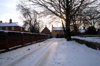
Church Lane Christmas Eve 2010
Population
At the time of the Domesday Book Cardington had a population of around 140 to 150 people, comparatively large for the time. In the last two hundred years Cardington has never been a particularly populous village, but numbers have dwindled considerably over the years to a point where the modern population is three fifths of that two hundred years ago; the figures below do not include those in the former township, now separate parish, of Eastcotts:
- 1801: 509
- 1811: 521
- 1821: 606
- 1831: 594
- 1841: 607
- 1851: 574
- 1861: 572
- 1871: 545
- 1881: 512
- 1891: 438
- 1901: 433
- 1911: 423
- 1921: 377
- 1931: 346
- 1951: 333
- 1961: 308
- 1971: 324
- 1981: 272
- 1991: 249
- 2001: 315
- 2011: 288