Westoning Maps
The following maps are only a selection of those held at Bedfordshire and Luton Archives and Records Service. To see larger versions of these historic maps of Westoning and the Woodends please click on the appropriate thumbnail.
The Westoning Inclosure Map of 1841
![The village in 1841 [MAT49]](/CommunityHistories/Westoning/WestoningImages/The village in 1841 [MAT49]_100x79.jpg)
The Village in 1841 [MAT49]
![Westoning Woodend in 1841 [MAT49]](/CommunityHistories/Westoning/WestoningImages/Westoning Woodend in 1841 [MAT49]_100x98.jpg)
Westoning Woodend in 1841 [MAT49]
Ordnance Survey Maps
1st Edition 25 Inches to the Mile Maps

The Village in 1882
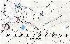
Harlington Woodend in 1882

Westoning Woodend in 1882
2nd Edition 25 Inches to the Mile Maps

The Village in 1901

Harlington Woodend in 1901

Westoning Woodend in 1901