The Parish of Westoning in General

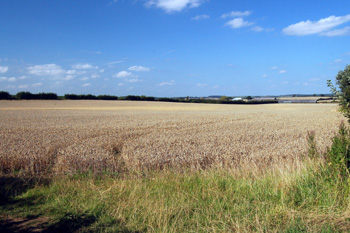
Countryside at Lower Sampshill August 2009
Landscape
Volume III of The Victoria County History for Bedfordshire was published in 1912. At this date the parish comprised 1,626 acres, 2 roods. Of this 524 acres were arable, producing wheat, barley, peas and beans whilst 820 acres, 2 roods were permanent grass.
The church stands at about 270 feet above sea-level whilst the Chequers public house is about twenty feet lower. The former Mother Redcap Inn is about the same height as the church and the eastern end of Sampshill Road reaches 290 feet.
The geology is quite complex. Solid geology was laid down in the warm, shallow seas of the Cretaceous Period and there are three types as follows:
- Gault Formation - a mudstone laid down between 99 and 112 million years ago. This underlies most of the village with an area to the south and at Sampshill. It also underlies some of Wood End;
- West Melbury Marly Chalk Formation - chalk laid down between 94 and 99 million years ago. This underlies some of the Sampshill area;
- Woburn Sands Formation - a sandstone laid down between 99 and 121 million years ago. This underlies some of the Sampshill area and some of Wood End.
Superficial geology overlies the solid geology and was deposited in the last two million years. Glaciofluvial deposits of sand and gravel left by glaciers during the mid-Pleistocene Epoch cover most of the area of the village as well as parts of Wood End. A mixture of sand, gravel, clay and silt called head, deposited by water, covers an area south of the village and parts of Wood End, where an alluvium of similar contents also appears. Finally a diamicton known as Lowestoft Formation covers some of the Sampshill area.

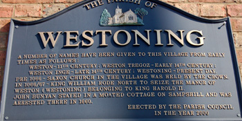
Local history plaque on the Clock Tower
Name
Westoning was originally just called Weston, meaning "west farm". It appears as Westone in the Domesday Book of 1086 and as late as 1365 and was sometimes called Weston Tregoz in the 13th century after the name of the family which held the manor. In 1373 it is first called Westonynge as Weston Manor had been acquired by a man named Ing, Chief Justice of Edward II (1307-1327), so the name should really have been Weston Ing.

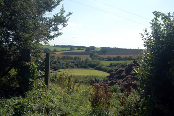
View at Sampshill August 2009
Administrative History
Westoning is an ancient parish in the Manshead Hundred. It is bounded by Flitwick to the north-west, Flitton to the north-east, Higham Gobion (part of the civil parish of Shillington from 1985) to the north-east, Harlington to the east and south and Tingrith to the west. In 1933 Harlington Wood End, a detached portion of Harlington was absorbed into Westoning [CDP54/4/1].
The village lies more or less in the middle of the parish. Clayhill Farm lies to the east and to the south-east lie Samshill and Upper Samshill Farms and Lovett Gardens a modern development lying on Harlington Road just west of Harlington Mill Nurseries. Harlington Wood End lies in the south-west, with Wood End just to the north of it.

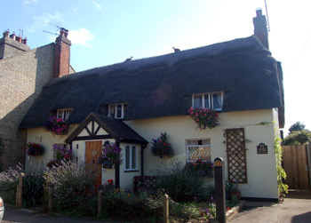
13 Church Road August 2009
Population
The population of Westoning at Domesday Book was 23, but this is simply heads of household, so the figure probably needs to be multiplied by a factor of four - giving just under a hundred, a decent sized settlement for the time.
The population today is five times that of two hundred years ago. The population rose steadily from 1801, reaching a peak in 1861. As agricultural mechanisation decreased jobs on the land the population then began to fall, reaching a low point in 1911 before increasing again. The biggest leap, with the building of new housing, came between 1971 and 1981 with an increase of around seven hundred.
- 1801: 410;
- 1811: 497;
- 1821: 634;
- 1831: 627;
- 1841: 732;
- 1851: 782;
- 1861: 784;
- 1871: 725;
- 1881: 657;
- 1891: 525;
- 1901: 501;
- 1911: 494;
- 1921: 521;
- 1931: 601;
- 1951: 788;
- 1961: 792;
- 1971: 1,122;
- 1981: 1,827;
- 1991: 1,797;
- 2001: 2,002;
- 2011: 2,147.