Milton Bryan Maps
The map below shows Milton Bryan at the time of inclosure in 1793, ten years before the birth of Sir Joseph Paxton. To see a larger version please click on the image
![The Milton Bryan inclosure map of 1793 [MA70]](/CommunityHistories/MiltonBryan/MiltonBryanImages/The Milton Bryan inclosure map of 1793 [MA70]_161x301.jpg)
The Milton Bryan inclosure map of 1793 [MA70]
The maps below are taken from the 2nd edition Ordnance Survey 25 inches to the mile map of Milton Bryan dating from 1901. To see a larger version please click on the image.
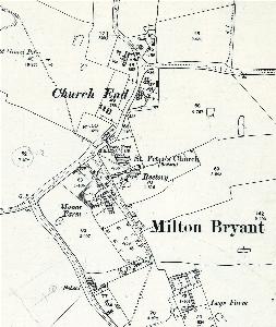
Church End in 1901
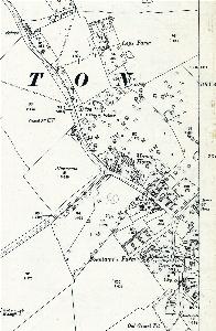
South End in 1901