The Parish of Husborne Crawley in General
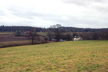
View from Husborne Crawley churchyard January 2008
The Landscape
Volume III of The Victoria County History published in 1912, before the loss of some land to help create the civil parish of Brogborough in 1990, reckoned the parish contained around 1,610.5 acres. Of this 413.5 acres were arable, 862.75 permanent grass and 202 acres were woods and plantations. The chief crops were wheat, barley and beans.
The church stands at about 330 feet above sea level whereas Crawley Brook, at the bottom of the hill lies at about 290 feet. Sandyland Plantation on Ridgmont Road rises up to about 415 feet above sea-level. At the other end of the spectrum, Ridgmont Station is only about 275 feet above sea-level.
The solid, or underlying, geology is mostly a type of greensand sandstone known as Woburn Sands Formation, laid down between 99 and 121 million years ago in shallow Cretaceous seas, though there are areas of a mudstone called Oxford Clay Formation, laid down between 154 and 164 million years ago in the Jurassic Period, along Crawley Brook, around Crawley Green and north-east and south-west of School Lane. The soil is thus sandy in some parts and clay in others. Around the Experimental Farm it is a mixture of sand, gravel, clay and silt known as head with a similar mixture, called alluvium, along Crawley Brook.
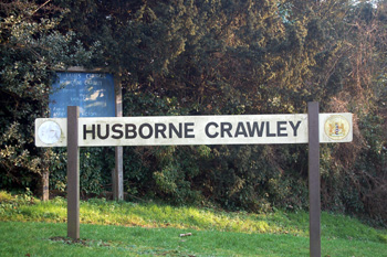
Husborne Crawley sign January 2011
Name
The meaning of the Husborne element is obscure, bo(u)rne means stream but it is not certain what the Hus means, unless it is from the Anglo-Saxon word "hyse" meaning young man or warrior; or it is, perhaps, a colloquial plant name. Crawley means "crow clearing". The name has appeared in the following forms over the years, the modern form of the name Husborne first appearing in 1250:
- Hysseburnan: 969-1229;
- Husseburn: c. 1200-1274;
- Husseburne: c. 1200-1274;
- Hesseburn: 1220;
- Hisseburn: c. 1220;
- Husburne: 1250-1428;
- Husseburn Crawele: 1276;
- Husseburn Crouleye: 1276;
- Hussebourne: 1291;
- Husband Crawley: 1535-1548;
- Husband Crauley: 1552;
- Husband: 1615.
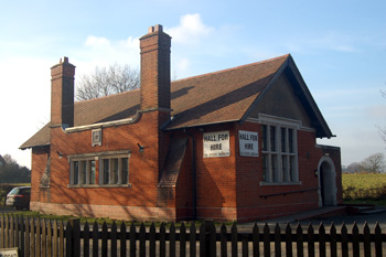
The Reading Room January 2011
Administrative History
Husborne Crawley is an ancient parish in the Manshead Hundred. It is first mentioned in a document of 969 setting out the boundaries of Aspley Guise. The charter mentions the boundary running: "From Hysse Burn to Wendlesdun; eastward from Wendlesdun to Flitan Hyll; thence on to the white moor, and afterwards by a fen to the chief field, up to the little knoll; thence to the apple tree where three land boundaries meet, of the men of Woburn and of the men of Wafandun, and of the men of Æpslea ... to the old charcoal pit where the three boundaries meet, of Cranefeld men, and of Mereston men, and of Holacot; from these three boundaries to the old maple tree; from the maple tree on to the long corner, always by the High Wood to the tall thorn tree; from the thorn tree again to the Hysse Burn, again to the eastward of Wendlesdun". Wendlesdun is Wednesden, the hill on the north side of Bedford Road amd the Hysse Burn is clearly Crawley Brook.
During the Middle Ages Crawley and Husborne Crawley were seen as two different places, presumably reflecting the two different manors. Crawley may have been in the south of the parish, perhaps from Crawley Brook southwards and Husborne Crawley may have been the area now known as Church End.
Husborne Crawley lost some of its area in the north of the parish in 1990 when Brogborough was made a separate civil parish. Today the northern boundary is the northern boundary of the southbound carriageway of the M1 motorway except for a small northern projection to take in Ridgmont Station. Husborne Crawley is bordered by Aspley Guise to the west, Hulcote to the north-west, Brogborough to the north, Ridgmont to the east and Woburn to the south.
Parts of Woburn Park are actually in the parish of Husborne Crawley, which does not stop at the park wall. The areas still in Husborne Crawley include Butt Close, Deane Hills, Sandylane Plantation, Brickground Plantation and the Deer Park. Parts of Woburn Safari Park, such as the entrance and the area devoted to rhinoceros, Ankole cattle, eland and zebra are in Husborne Crawley.
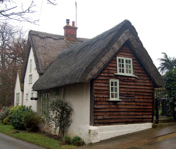
The Thatched Cottage January 2008
Population
The Domesday Book of 1086 records 19 people in Husborne Crawley. These are just the heads of households and so the figure must be multiplied by a factor of at least four, suggesting around 75 people.
The population of Husborne Crawley below is taken from census returns. The population has been halved since the end of the 19th century and reduced by two thirds from the figures in the first half of the century. Smaller families and the move of people away from the countryside and to the towns to find work contribute greatly to this and Husborne Crawley has been spared the massive house-building programmes inflicted on some other Bedfordshire parishes.
- 1801: 543;
- 1811: 493;
- 1821: 572;
- 1831: 680;
- 1841: 656;
- 1851: 614;
- 1861: 535;
- 1871: 527;
- 1881: 479;
- 1891: 410;
- 1901: 397;
- 1911: 365;
- 1921: 359;
- 1931: 326;
- 1951: 317;
- 1961: 382;
- 1971: 381;
- 1981: 332;
- 1991: 246;
- 2001: 216;
- 2011: 237.