Great Barford Maps
The following maps are only a selection of those held at Bedfordshire and Luton Archives and Records Service. To see a larger version of each map, please click on the appropriate image.
Ordnance Survey 1st Edition 25 inches to the Mile Maps of 1883-1884
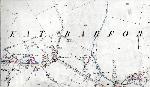
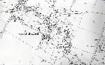
Green End in 1883
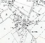
The main part of the village in 1884
The area around Barford Bridge in 1884
Ordnance Survey 2nd Edition 25 inches to the Mile Maps of 1901
Green End in 1901
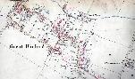
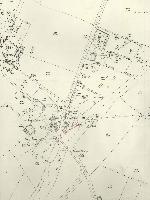
The main area of the village in 1901
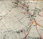
The area around Barford Bridge in 1901
Ordnance Survey 3rd Edition 25 inches to the Mile Maps of 1926

Green End in 1926
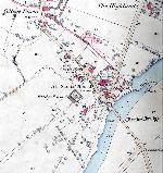
The main part of the village in 1926
The area around Barford Bridge in 1926
Field Names plotted by the first County Archivist George Herbert Fowler on 6 inch Ordnance Survey Maps of 1902
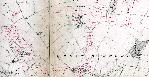
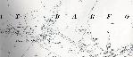
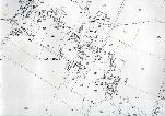
Great Barford field names north of the village
 Field names in Great Barford