Yelden Maps
The map below is the tithe apportinment map for Yelden dated 1842. Tithes were, historically, tenths of produce given to the church by those in a parish. Tithe apportionment simply made statutory a process long in use whereby these tithes of produce were substituted for money payments. To see a larger version please click on the map.
![Yelden in 1842 [MAT54]](/CommunityHistories/Yelden/YeldenImages/Yelden in 1842 [MAT54]_181x300.jpg)
Yelden in 1842 [ref: MAT54]
The two maps below are second edition 25 inches to the mile Ordnance Survey maps dating from 1901. To see a larger version please click on the appropriate image
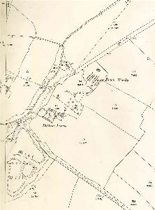
The area around the castle 1901
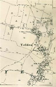
The western part of the village 1901