Souldrop Maps
The map below shows the village of Souldrop in an estate map made for the Duke of Bedford in 1822 [X1/32]. To see a larger version please click on the image
![Souldrop in 1822 [X1-32]](/CommunityHistories/Souldrop/SouldropImages/Souldrop-in-1822-X1-32173x299.jpg) Souldrop in 1822
Souldrop in 1822
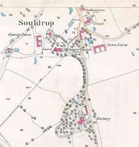
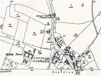
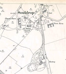
The maps below are from the 25 inches to the mile Ordnance Survey 1st series (1879-1885) and 2nd series (1901). Again, to see a larger version please click on the relevant image.

The northern part of the village in 1884
The southern part of the village in 1884
The northern part of the village in 1901
 The southern part of the village in 1901