The Parish of Meppershall in General
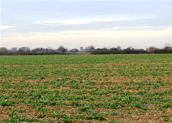
View west from Chapel Road to the village March 2015
Landscape
Most of the solid, or underlying, geology in this parish is of a type known as Gault Formation. This is a mudstone laid down between 99 and 112 million years ago. In the centre of the village the superficial geology is made up of glaciofluvial deposits – sand and gravel formed during the Ice Ages. The superficial geology along Shefford Road and east, north and south of the eastern part of Fildyke Road is a type of diamicton called Lowestoft Formation. In areas north and south of Stondon Road the solid geology is chalk of a type called West Melbury Marly Chalk Formation – laid down between 94 and 99 million years ago in the warm shallow seas of the Cretaceous Period.
The village of Meppershall lies on a low ridge above the valleys of the Flit and Ivel. The church stands 286 feet above sea-level, with the Rectory Road/Stondon Road/Shillington Road junction at 274 feet. The junction of Chapel Road with Fildyke Road is quite a bit lower at 226 feet.
Name
Meppershall means "Mathalperht's corner of land". This Anglo-Saxon personal name is very rare from surviving sources and in their seminal volume of 1926 on the place names of Bedfordshire and Huntingdonshire A. Mawer and F. M. Stenton theorise that Mathalperht may have been a thegn from the continent. The name has had a number of forms through history as follows:
- Malpertesselle: 1086;
- Maperteshale: 1086;
- Maperteshala: 1190-1198;
- Meperteshale: 1200-1490;
- Mainpardeshal: 1203;
- Maperteshale: 1202-1255;
- Mepardeshale: 1227;
- Mauperteshal': 1233;
- Meperdeshale: 1247-1445;
- Mepereshale: 1316-1369;
- Mepershale: 1316-1369;
- Mepersale: 1331;
- Meparteshale: 1347;
- Mapartysshall: 1494;
- Meppertyshall: 1494;
- Mepersall: 1526;
- Mepsall: 1610-1635;
- Meppershall: 1806
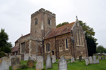
The church from the south-east September 2014
Administrative History
Meppershall is an ancient parish, partly in the Clifton Hundred and partly in the Hertfordshire Hundred of Dacorum, the latter element being transferred to Bedfordshire in 1832 as far as parliamentary constituency was concerned, being added to the civil parish in 1844. The parish of Clifton lies to the east, as does part of the parish of Henlow. The ancient parish of Upper Stondon (part of the civil parish of Stondon from 1985) lies to the south, as does Shillington. Upper Gravenhurst (civil parish of Gravenhurst from 1888) lies to the east, Campton to the north-west and Shefford to the north.
![10-12 Rectory Road about 1960 [Z55/74/50]](/CommunityHistories/Meppershall/MeppershallImages/10-12 Rectory Road about 1960 [Z55-74-50]_352x271.JPG)
10-12 Rectory Road about 1960 [Z55/74/50]
Population
The Domesday Book of 1086 notes that the Manor of Meppershall comprised five villagers, four smallholders and two slaves. These eleven people would have been heads of household so the number needs to be multiplied by a factor of at least four. This suggests a population of fifty or below making the settlement a small one even by the standards of the day.
Census figures from 1801 to 1911 show changes set out below. In the last fifty years the population has more than doubled. Before that it had hovered in the 600s and 700s for ninety years. Unlike many parishes it does not show a marked dip in the period of the great agricultural depression of 1873 to 1896, perhaps due to its proximity to the growing small town of Shefford.
- 1801: 309;
- 1811: 296;
- 1821: 379;
- 1831: 444;
- 1841: 487;
- 1851: 503;
- 1861: 541;
- 1871: 613;
- 1881: 778;
- 1891: 650;
- 1901: 655;
- 1911: 610;
- 1921: 632;
- 1931: 769;
- 1951: 657;
- 1961: 725;
- 1971: 917;
- 1981: 1,248;
- 1991: 1,382;
- 2001: 1,546;
- 2011: 1,745.