The Parish of Ridgmont in General
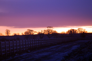
Dawn over the Ridgmont Bypass December 2008
Landscape
Volume III of The Victoria County History published in 1912 reckoned the parish contained around 2,308 acres almost equally divided between arable farming and grassland. Principal crops were then wheat, barley and beans. Some of this acreage was lost when the new civil parish of Brogborough was formed in 1990. The new parish was formed from parts of both Ridgmont and Husborne Crawley civil parishes.
Ridgmont church stands at just under 400 feet above sea-level with Segenhoe church about ten feet lower. the ground falls away somewhat to the east with Beckerings Park Manor Farm standing at about 335 feet. At the bottom of the scarp slope, at the junction of Mill Road with Station Road the neight is only about 270 feet above sea-level.
A few small streams cross the parish but water supply was, historically, from wells. A low water tower was built in the 20th century just south of the church to draw up water.
Most of the parish has a solid, or underlying, geology of a sandstone called Woburn Sands Formation, laid down in warm, shallow Cretaceous seas between 99 and 121 million years ago. A band of mudstone called Oxford Clay, however, runs along the scarp slope and lies beneath the plain running north of that. The soils reflect the nature of the sub-soil, either sand or clay but along the scarp slope is a mixture of sand, clay, gravel and silt described as head. Segenhoe and the south-west parts of the High Street have a covering of glacial till, a diamicton deposited in the Ice Ages of the mid Pleistocene Epoch.
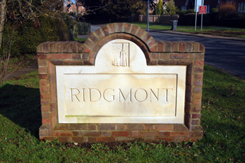
Sign at the entrance to the village January 2011
Name
The name Ridgmont is unusual for Bedfordshire in being Norman French in origin rather than Anglo-Saxon. The original is "rouge-mont" meaning red hill and the soil here is certainly deep reddish brown. The name has appeared in the following forms over the years:
- Rugemund: 1227;
- Rogemund: 1276-1287;
- Rychemund: 1276;
- Rugemunt: 1286-1355;
- Richemond: 1287;
- Rugemond: 1316;
- Rougemont: 1349-1368;
- De Rubeo Monte: 1349-1358;
- Rouge Mount: 1368;
- Regemond: 1526-1530;
- Regemont: 1526-1530;
- Richmount: 1527;
- Ridgemond: 1535-1549;
- Rydgemonde: 1535-1549.
Ridgmont is a later settlement being mentioned for the first time, as can be seen above, only in 1227. The original settlement was at Segenhoe. The name Segenhoe includes the personal name Segga and the Anglo-Saxon word "hoh" meaning a spur of land. The name thus means Segga's spur of land. It has appeared in the following forms over the years:
- Segenehou: 1086;
- Segenho: 1220-1224;
- Segenhou: 1220-1224;
- Sekenho: 1234;
- Seggenhou: 1247;
- Seginho: 1286;
- Segonho: 1346;
- Sedgynhoe: 1526;
- Segnoo: 1526-c. 1750;
- Segnow: 1526-c. 1750;
- Segnew: 1527;
- Sedgenow: 1535.
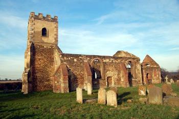
Segenhoe church from the south February 2007
Administrative History
Ridgmont does not occur in the Domesday Book of 1086 and probably did not exist. Its French name indicates that it was probably created some time after the Norman Conquest of 1066. The Anglo-Saxon settlement was at Segenhoe, now completely abandoned apart from Segenhoe Manor (house) and Segenhoe Manor Farm. There was likely drift from Segenhoe to Ridgmont going on over centuries as there were still dwellings at Segenhoe in the 18th and 19th centuries as shown on the inclosure map of 1799 [MA15]. Segenhoe was an ancient parish lying in the Redbornestoke Hundred.
Ridgmont is bordered by Husborne Crawley to the west, formerly by Hulcote, now by Brogborough to the north-west, Lidlington to north-east, Millbrook to the east, Steppingley to the south-east and Eversholt and Woburn to the south.
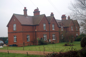
17 to 23 Eversholt Road December 2010
Population
The Domesday Book of 1086 records 31 people in Segenhoe. These are just the heads of households and so the figure must be multiplied by a factor of at least four, suggesting around 120 people, making it a reasonably sized settlement for the time, bigger, for example, than nearby Aspley Guise.
The population of Ridgmont peaked in the mid 19th Century, reaching its highest point at 1,029 in 1861 and then again in the mid 20th century reaching its highest point, 983 in 1951. The peak in the 20th century is easily explained by the development of the Crown Brickworks site at Brogborough, then in the parish of Ridgmont and where the modern [2011] warehouses, including Amazon, are situated near Junction 13 of the M1. On the closure of the brickworks the population once more declined. Brogborough became a separate civil parish in 1990. The figures below are taken from census returns.
- 1801: 581;
- 1811: 677;
- 1821: 810;
- 1831: 992;
- 1841: 964;
- 1851: 999;
- 1861: 1,029;
- 1871: 910;
- 1881: 740;
- 1891: 658;
- 1901: 591;
- 1911: 540;
- 1921: 494;
- 1931: 497;
- 1951: 983;
- 1961: 808;
- 1971: 671;
- 1981: 626;
- 1991: 408;
- 2001: 418;
- 2011: 411.