The Manor of Ridgmont Bevans
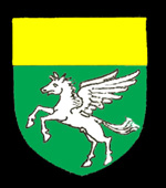
The MacQueen family coat of arms
The histories of manors in Ridgmont are given in Volume III of The Victoria County History for Bedfordshire published in 1912. Walter, brother of Sihere owned a manor of ten hides as recorded by the Domesday Book of 1086. It is from this manor that all the medieval manors in Ridgmont and Brogborough stem.
Bevans Manor takes its name from the Bevan family, a Richard Bevan holding land in Ridgmont in the 13th century. In 1276 Walter Bevan held a carucate of land above Ridgmont Castle. The land is last mentioned in 1346 when held by Thomas Bevan.
In 1593 William Stone was recorded as dying owing two-thirds of Bevans Manor. He also held Segenhoe Manor. The Stone family were Lords of the Manor until the middle of the 17th century when it was conveyed to Elizabeth Dodsworth. The Dodsworths sold their estates around 1670 to Francis Lowe.
In 1738 Simon Taylor held the manor but by 1801 it was in the possession of the MacQueen family, like Segenhoe Manor. The manor was then absorbed into the larger Manor of Segenhoe,
The Bedfordshire Historic Environment Record [HER] contains information on the county's historic buildings and landscapes and summaries of each entry can now be found online as part of the Heritage Gateway website. The record [HER 28911] includes a moat which is thought to be the site of Bevans Manor, lying south-west of Segenhoe church. The description reads as follows.
"Amedieval moated enclosure and its associated outer enclosure and cultivation earthworks [HER 2811] lies at Malting Spinney, south-west of Segenhoe church. The moated enclosure is rhomboidal in shape measuring about forty metres across including the twelve metre wide surrounding moat. The island is raised one metre higher than the adjacent area. The moat is currently dry with no evidence for the location of an entrance causeway or bridge".
"Adjoining the moated enclosure is a rectangular outer court or enclosure. The outer enclosure measures about seventy five metres by one hundred and ten metres and is defined by an eight metre wide ditch along its northern and western sides, connected to the moat at its north angle. The southern and eastern boundaries of the outer enclosure are defined by a low outer bank and ditch which join the moated enclosure at its south angle. The interior of the outer enclosure is level with no visible remains of buildings or features recorded as existing at the site. Immediately to the south-east of the moat and outer enclosure are the well-preserved remains of cultivation earthworks. The ridges and furrows of this field system stop short of the outer enclosure, and are therefore considered to be later or contemporary with the outer court". A reminder of the manor comes in the form of Lower Bevins just over the southern parish boundary in the parish of Eversholt.