Studham Before 1086
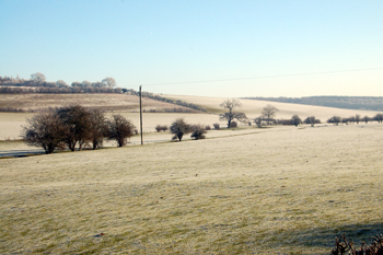
Looking towards the proposed Iron Age hillfort from Hudnall Corner January 2010
The Historic Environment Record for Bedfordshire [HER] is invaluable for anyone wishing to research the archaeology and landscape history of a Bedfordshire parish. One might expect that Studham, being high on chalk downland, would have produced considerable evidence of prehistoric settlement, especially considering that Bedfordshire's best surviving prehistoric monuments are only a short distance away in Dunstable and Luton. However. The surviving evidence for early prehistory in Studham, however, is slight whilst that for the Iron Age and Romano-British periods is somewhat conjectural.
The Palaeolithic Era
The Old Stone Age was the most remote epoch of modern human development and evidence for human activity from this time usually comes only from finds of artefacts rather than evidence of structures in the landscape. A Lower Palaeolithic ovate hand axe was found in the garden of 57 Woodland Rise in 1994 [HER 15869]. No evidence of Mesolithic activity has yet been found in Studham.
The Neolithic Era
The New Stone Age was when people first began to settle down in one place and undertake arable and livestock farming. Part of a polished flint axe of Neolithic date was found about 1966 on land belonging to Rose Nurseries between Clements End Road and Byslips Road. Other flints have been recorded from the same field [HER 2022].
Two scatters of flint implements dating to the Neolithic or early Bronze Age have been found by field walking either side of Longspoons Wood. One scatter lay to the west [HER 17720] and included small quantities of blades, flakes, points, pot boilers and scrapers. The scatter to the east of the wood [HER 17721] consisted of fire fractured flints.
The Iron Age
The Historic Environment Record records three potential Iron Age sites in Studham, two of lynchets and one of a possible hillfort. Lynchets, historically referred to as "Celtic Fields", are terraces formed in the side of a hill by cultivation. The earliest are usually dated to the Iron Age although the practice continued through into the Middle Ages, making them difficult to date with any certainty.
There are historic references to Celtic Fields being visible bordering the Grade Valley in the parishes of Studham and Great Gaddesden [Hertfordshire]. A site visit in 1981 to one of these areas of lynchets, in Lower White Croft Field [HER 10946], found two nearly ploughed out lynchets visible. The other site nearby [HER 10947] was identified by parch marks on an aerial photograph of 1976.
The hillfort [HER 11021] occupies a pronounced south facing spur, at the southernmost part of the parish and county. The Historic Environment Record notes that the site: "shows slight indications of cropmarks, possibly of defensive ditches. The Field name, 'Kilbury Camp' was recorded in the area in 1797. Viewed stereoscopically aerial photographs bring out a clear south facing spur of high ground, which would be a classic location for a promontory fort. Slight cropmarks may suggest lengths of curving ditch around the south end of the hill and a possible angle at the north-west corner".
Romano-British Period
The Romans landed in Britain in 43 AD and spent the next few years pacifying what is, today, England and Wales, the border at one point in the 2nd century reaching into southern Scotland. The Romans left, according to The Anglo-Saxon Chronicle in 410 AD.
Bedfordshire Historic Environment Record notes that The Viatores, a group dedicated to researching Roman roads in Britain, identified a road running from Elstree [Hertfordshire] to the Icknield Way [HER 696] running through the Bedfordshire parishes of Studham and Whipsnade and Eaton Bray. They traced this proposed route partly from extant earthworks; some of the route, inevitably, is conjectural.
The other three potential Romano-British features are all suggested aggers. These were roads with a ditch at either side and raised in the middle, the modern name deriving from the Latin word meaning a causeway. One of these is at Lamb's Spring [HER 5050] and another in Clappers Wood [HER 5151]. A third agger at Barwythe [HER 8800] may be part of the road identified by the Viatores.