The Parish of Little Barford in General

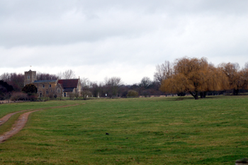
Little Barford church and the site of the deserted Medieval village February 2010
Landscape
Volume II of The Victoria County History for Bedfordshire was published in 1908. At that time the parish comprised around 1,200 acres of which about half was arable land and half permanent grazing. The main crops were wheat, barley, oats, beans and market gardening produce.
The lowest point in Little Barford lies just 61 feet above sea-level, in the west of the parish bordering the River Great Ouse. The highest point lies at 187 feet at Hungry or Crane Hill. The church stands at 68 feet above sea-level and the power station around 80 feet.
The solid, or underlying, geology is a form of mudstone known as Oxford Clay Formation formed between 154 and 164 million years ago in warm, shallow Jurassic seas. Not surprisingly much of the soil is, therefore, clay also, though along the river there is an alluvium of sand, gravel, silt and clay and river terrace deposits of sand and gravel lie west of Barford Road. There is a large area of glacially deposited sand and gravel east of the road and running the length of the village.

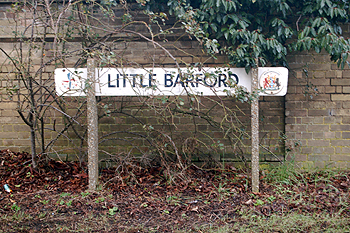
Little Barford sign February 2010
Name
Little Barford has only been Little Barford since the 17th century, being simply known as Barford or Barkford before that, despite another Barford (called Great Barford from the 17th century) lying nearby. The reason for this is that the Barford element in the name means quite different things in each parish meaning that the name developed differently and was sufficiently different in form before the 17th century not to give rise to confusion. In the case of Little Barford, which was first recorded in the Domesday Book of 1086, the name means "birch tree ford". The name has undergone a wide set of variations with Barford first used in 1539:
- Bereforde: 1086-1167;
- Berkeford: 1202-1581;
- Berckford: 1220-1291;
- Berckeford: 1220-1291;
- Bercford: 1247-1250;
- Berkford: 1269-1576;
- Berford: 1284;
- Berecforde: 1346;
- Barkford: 1415-1748.

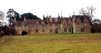
The rear of The New Manor February 2010
Administrative History
Little Barford is an ancient parish in the Barford Hundred. It was bordered to the west by Eaton Socon, now by the civil parish of Staploe, the boundary here being the River Great Ouse. A small part of the south-west was bordered by Roxton, now by the civil parish of Wyboston, Chawston and Colesden. Little Barford is bounded to the south by Tempsford, and to the north-east and east by the Cambridgeshire parish of Eynesbury. Some minor boundary changes with Cambridgeshire occurred in 1991.

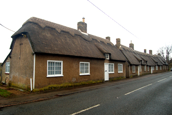
1 to 4 The Bungalows February 2010
Population
The Domesday Book of 1086 recorded thirteen villagers, six smallholders and eight slaves in Little Barford - a total of twenty seven heads of household suggesting, once wives and children are taken into account, a population of a little over a hundred, a very respectable sized settlement for the time and greater than the number of inhabitants in 1801 which was merely eighty and more than twice that of today's parish! The population fluctuated in the following years, reaching a high point of nearly two hundred in 1841 and 1881. As the twentieth century progressed the population fell until a low point of thirty three in 1991 from which has risen a little since.
- 1801: 80;
- 1811: 73;
- 1821: 123;
- 1831: 176;
- 1841: 190;
- 1851: 112;
- 1861: 91;
- 1871: 123;
- 1881: 189;
- 1891: 166;
- 1901: 137;
- 1911: 151;
- 1921: 121;
- 1931: 75;
- 1951: 88;
- 1961: 68;
- 1971: 49;
- 1981: 45;
- 1991: 33;
- 2001: 42.