Little Barford Maps
The following maps are only a selection of those held at Bedfordshire and Luton Archives and Records Service. This map of Little Barford is taken from Jefferys' map of the county of 1765 [R1/100].
![Little Barford in 1765 [R1/110]](/CommunityHistories/LittleBarford/LittleBarfordImages/Little Barford in 1765 [R1-110]_349x173.jpg)
Little Barford in 1765 [R1/100]
The map below shows Little Barford in 1840 [MAT2/1]. It is taken from a Tithe Apportionment Award. To see a larger version, please click on the image
![Little Barford in 1840 [MAT2-1]](/CommunityHistories/LittleBarford/LittleBarfordImages/Little Barford in 1840 [MAT2-1]_340x267.jpg)
Little Barford in 1840 [MAT2/1]
The maps below show Little Barford in 1901, the first is the area of the main village (to see a larger version, please click on the image), the second is the area around Top Farm.
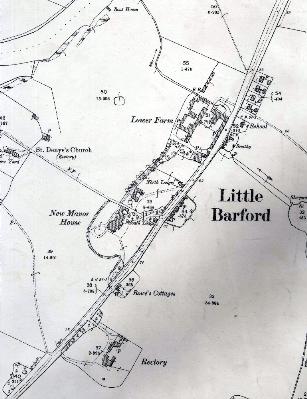
Little Barford in 1901
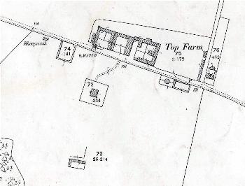
Top Farm in 1901
The map below is an Ordnance Survey 1902 6 inches to the mile map annotated by the first County Archivist, Doctor George Herbert Fowler to show field names: to see a larger version, please click on the image.
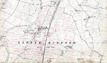
Little Barford field names