The Parish of Mogerhanger in General
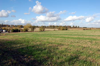
Countryside south of Mogerhanger October 2009
Landscape
Mogerhanger consists of approximately 1,815 acres, lying in between the River Ouse, at its northwest tip, and the River Ivel, which runs southward along its eastern edge. Its land is, on the whole, low-lying, with a rise to the north of the village; the church of Saint John the Evangelist stands on this higher ground at about 145 feet above sea-level. Mogerhanger House is higher at about 178 feet. Willowhill Farm, west of the village is only just over a hundred feet above sea-level and Bridge Farm to the east of the village near the River Ivel just 75 feet.
The solid, or underlying, geology is a type of mudstone known as Oxford Clay Formation, laid down between 154 and 164 million years ago in the warm, shallow seas of the Jurassic Period. Not surprisingly most of the soil is clay.
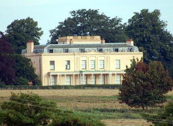
Mogerhanger House August 2009
Name
The meaning of its name—Mogerhanger or Morhanger—is still somewhat uncertain. The second element is from the Old English ‘hangra’, meaning "wood"; the first element is obscure: it may be a personal name, something like Moker or Muker or may be from the Old English word muker meaning a miser - thus Miser's Wood - a place where a hoard was discovered has been suggested.
Even now the parish tends to be spelled both with one ‘g’ (generally when referring to the civil parish) and two (generally in reference to the ecclesiastical parish); on the latest Ordnance Survey maps, the civil parish is spelt as Mogerhanger, with local pronunciation being ‘Morhanger’. As might be expected the name has undergone quite a number of variations since its first mention in any surviving document in 1216:
- Mogarhangre: 1216;
- Moggehangre: 1220;
- Mogerhanger: 1240 to date;
- Mokehangre: 1242;
- Moukeraungre: 1276;
- Mokerhanger: 1276-1398;
- Mokerhangre: 1276-1398;
- Mougerhanger: 1287;
- Mouerhanger: 1289;
- Moggurhangger: 1347;
- Mokerangre: 1394;
- Moker Aungre: 1394;
- Mogranger: 1474-1535;
- Mogreangre: 1488;
- Mogeranger: 1517-1535;
- Mowgranger: 1629;
- Morehanger: 1675;
- Muggeranger: c.1750;
- Muggerhanger: 1780-1830.
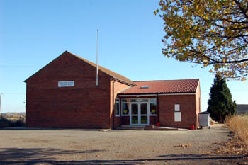
The Village Hall in November 2007
Administrative History
Mogerhanger was a hamlet of Blunham. In 1860 it became a separate ecclesiastical parish and a separate civil parish in 1866. The civil parish includes the hamlets of Chalton and South Mills. It was enlarged a little with land from Northill parish by means of a parish boundary shift in 1882.
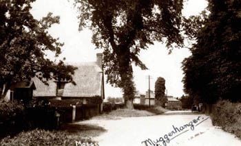
The village about 1930
Population
The population of Mogerhanger today is nearly double that of 1801. Although a hamlet of Blunham until 1861 Mogerhanger's population figures were always recorded separately:
- 1801: 345;
- 1811: 385;
- 1821: 405;
- 1831: 381;
- 1841: 425;
- 1851: 455;
- 1861: 503;
- 1871: 495;
- 1881: 404;
- 1891: 430;
- 1901: 432;
- 1911: 430;
- 1921: 398;
- 1931: 575;
- 1951: 618;
- 1961: 561;
- 1971: 579;
- 1981: 631;
- 1991: 659;
- 2001: 638;
- 2011: 620.