The Parish of Stanbridge in General
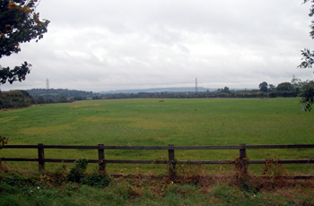
Looking south from Tilsworth Road October 2008
Landscape
The civil parish of Stanbridge contains 1,515 acres [613 hectares]. The lowest point in the parish is in the south around Stanbridgeford which lies at 300 feet above sea level. The highest point is to the north-east of the old windmill, in the area of the medieval windmill, at 420 feet. The church is about 360 feet above sea-level and Mead Farm about 320 feet.
The solid, or underlying, geology beneath the village is a mudstone called Gault Formation, laid down between 99 and 112 million years ago in the warm, shallow seas of the Cretaceous Period. The slope and southern part of the plateau north of the village is a mudstone called Upper Greensand Formation, laid down between 94 and 112 million years ago. North of this the bedrock changes to gault clay again which also underlies Stanbridgeford.
Superficial geology lies above the solid geology and was deposited in the last two million years. Around Stanbridgeford is, not surprisingly, a river-borne alluvium of sand, gravel, silt and clay. Some of the dry valleys running down from the plateau in the north of the parish contain a similar mixture called head. Further north the superficial geology is a glacially deposited diamicton called till.
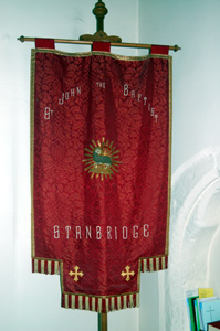
The parish banner December 2008
Name
The name Stanbridge means stone bridge. The name has undergone a number of variations over the course of its history as follows:
- Stanbrugge (1165-1405);
- Stanbruge (1165-1405);
- Stanbrug (1165-1405);
- Stanbregge (1196);
- Stanbrige (1202-1497);
- Stanbrigge (1202-1497);
- Stanbrygge (1202-1497);
- Staunbrig (1227-1247);
- Staunbrigg (1227-1247);
- Stanburgh (1227);
- Stanbrig (1240);
- Stanbrich (1276);
- Stambrug (1292);
- Staundbridge (1785)
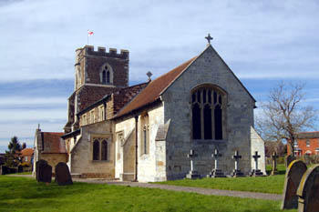
Stanbridge church from the south-east March 2008
Administrative History
Stanbridge was a hamlet in the parish of Leighton Buzzard and is first mentioned in Pipe Rolls in 1165. It became a separate ecclesiastical parish in 1735, though ministered to by a curate rather than a vicar for many years. In 1866 it became a separate civil parish. Stanbridge is bordered by Tilsworth to the east, Totternhoe to the south-east, Eaton Bray to the south, Billington to the west and Eggington to the north.
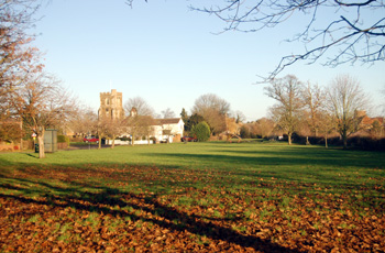
Stanbridge Green December 2008
Population
The Hearth Tax of 1671 (transcribed in Bedfordshire Historical Records Society Volume 16 in 1934) records 42 dwellings in Shefford for a total of 81 hearths. It has been estimated that this represented a population of about 234. The largest number of hearths, five, were in the house of James Grant. The house of John Snoxell contained a forge, clearly suggesting he was the smith. Thirteen persons in the township "received constant alms".
The occasional visitation by the Bishop of Lincoln to Bedfordshire in the early 18th century gives important social information. Each vicar or rector had to complete a return about his parish. These are particularly useful for the state of education but give other insights. Former County Archivist Patricia Bell has compiled returns from 1706 to 1720 for the Bedfordshire Historical Records Society (Volume 81, published 2002); information for Stanbridge is included in the return for Leighton Buzzard for 1706 only and is as follows: "In the Hamlet of Stanbridge 45 families [48 inserted] Souls 235".
Census returns enable us to chart the population figures in Stanbridge from 1801; the drop in population around the turn of the 19th and 20th centuries is measured in many villages as jobs on the land decreased, forcing a move to towns:
- 1801: 262;
- 1811: 325;
- 1821: 407;
- 1831: 416;
- 1841: 519;
- 1851: 597;
- 1861: 554;
- 1871: 586;
- 1881: 512;
- 1891: 402;
- 1901: 342;
- 1911: 368;
- 1921: 378;
- 1931: 377;
- 1951: 416;
- 1961: 625;
- 1971: 804;
- 1981: 747;
- 1991: 710;
- 2001: 746;
- 2011: 713.
The former Handy Shop at 2 Peddars Lane June 2008