Stanbridge Maps
The following maps are only a selection of those held at Bedfordshire and Luton Archives and Records Service. To see a larger version of each map, please click on the thumbnail.
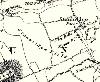
Stanbridge on Bryants Map of 1826
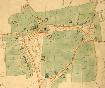
This section of the Stanbridge Inclosure Map of 1840 [MA60] shows the centre of the village.

The eastern part of the village on the Ordnance Survey 25 inches to the mile second edition map of 1901

The western part of the village on the Ordnance Survey 25 inches to the mile second edition map of 1901
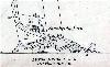
Stanbridgeford on the Ordnance Survey 25 inches to the mile second edition map of 1901
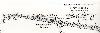
Stanbridgeford Station on the Ordnance Survey 25 inches to the mile second edition map of 1901