Flitwick Maps
The images below are from the inclosure map of about 1808 [MA68. To see a larger version, please click on the relevant image.
![Church End about 1808 [MA68] note the top of the map is north-east](/CommunityHistories/Flitwick/Flitwick-Images/Church-End-about-1808-MA68-note-the-top-of-the-map-is-north-east256x299.jpg)
Church End about 1808 [MA68] note the top of the map is north-east
![Denel End about 1808 [MA68] note the top of the map is north-east](/CommunityHistories/Flitwick/Flitwick-Images/Denel-End-about-1808-MA68-note-the-top-of-the-map-is-north-east324x299.jpg)
Denel End about 1808 [MA68] note the top of the map is north-east
![East End about 1808 [MA68] note the top of the map is north-east](/CommunityHistories/Flitwick/Flitwick-Images/East-End-about-1808-MA68-note-the-top-of-the-map-is-north-east297x299.jpg)
East End about 1808 [MA68] note the top of the map is north-east
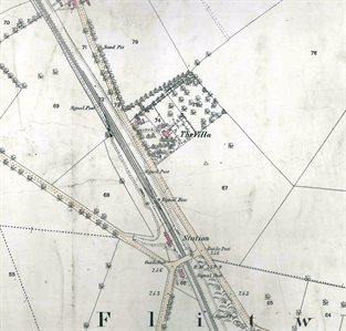
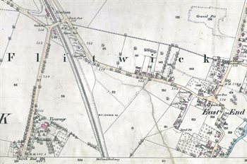
The images below are from the first edition Ordnance Survey 25 inches to the mile maps of 1882. Again, to see a larger version, please click on the relevant image
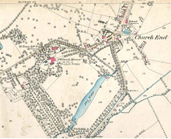
Church End in 1882
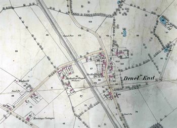
Denel End in 1882
The southern part of Denel End in 1882
The Vicarage and station in 1882
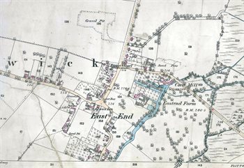
East End in 1882